Wugongshan: Alpine Grassland & Camping
Wugong Mountain (Wugongshan): alpine meadows, summit tent camping, cable cars and a famous sea of clouds. Routes, gear and getting there from Nanchang.
By Hello Nanchang · Last updated
Wugong Mountain, Pingxiang, Jiangxi Province, China · Best Mar–Oct (peak summer); 1–2 days. Golden Summit 1,918 m — windy & cool, even in summer
Why Wugongshan?
At half past four the meadow is the colour of wet slate and the only sound is nylon — a few hundred tent flies snapping in the wind. Then head-torches start moving uphill in a thin, wobbling line. By five the ridge is crowded with people wearing rented padded coats over shorts, all facing the same slot in the eastern sky, and below them the valleys have filled overnight with cloud so flat you could believe you'd walk out across it. That is why anyone sets an alarm for Wugongshan (武功山, Wǔgōngshān).
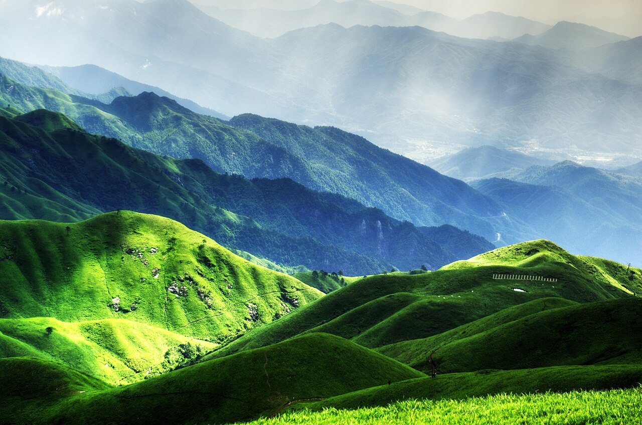
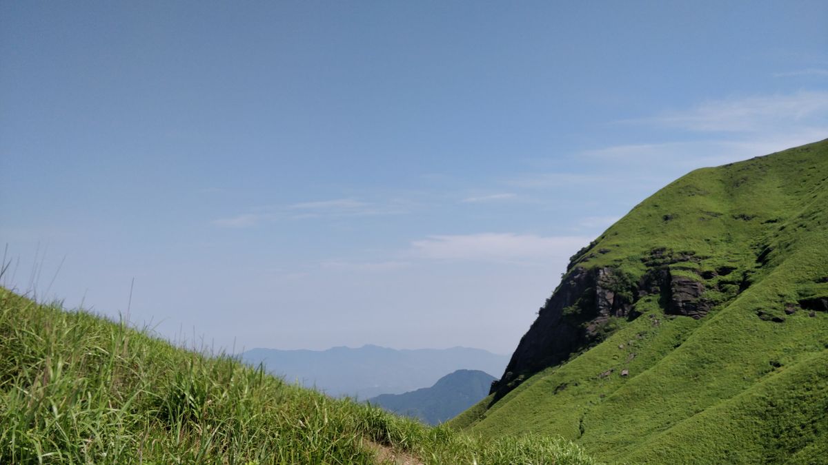
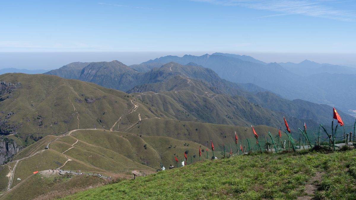
Forget the usual Chinese-mountain image of stone staircases and temple-topped crags. Wugongshan is something rarer: rolling, open alpine grassland draped across high ridges — green, treeless and improbably Scottish-looking for subtropical Jiangxi. The meadow is the mountain's whole identity. Roughly 100,000 mu of it (call it 65 square kilometres) runs along the ridgelines above about 1,600 m, which local geologists like to point out is the highest and largest alpine grassland at this latitude anywhere on earth. The best stretch lies between the Golden Summit and Fayunjie (发云界), and you walk it for hours on boardwalk and dirt path with nothing taller than your knees.
The signature landscape: treeless meadow rolling along the ridge above 1,600 m. Photo: Huangdan2060 / CC0, via Wikimedia Commons.
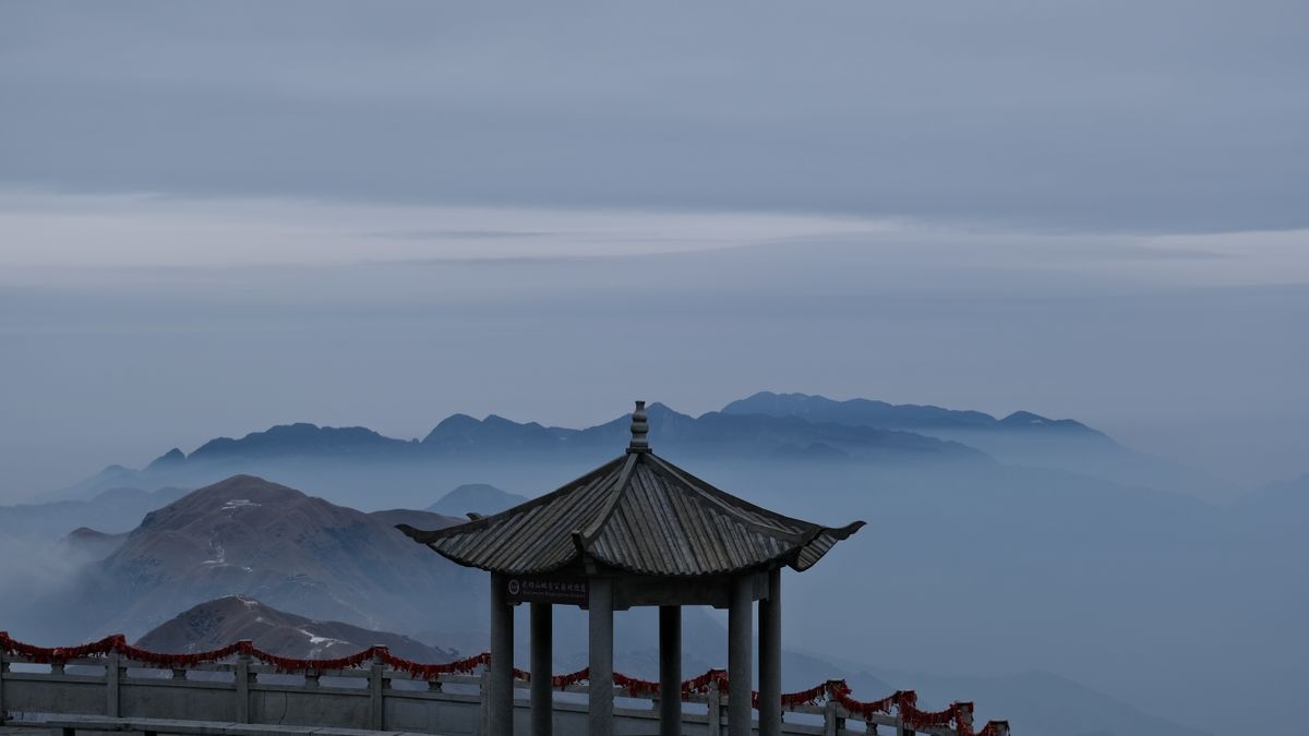
The signature experience is to sleep up there in a tent and wake for sunrise above the clouds. The Golden Summit (金顶, Jinding) — also called White Crane Peak — tops out at 1,918.3 m on the Pingxiang/Ji'an border, the highest point in Jiangxi. It's a mountain built for hikers and campers, but two stacked cable cars mean people with no intention of hiking anywhere can still stand on the meadow by lunchtime.
The honest positioning: Lushan is the mountain you take your parents to; Wugongshan is the one you take your legs to. They pair well — the Jiangxi summer escape route chains them into one trip.
How to get to Wugongshan from Nanchang
A high-speed train west, then a bus up to the trailhead. Budget about three hours door to gate.
- Train to Pingxiang North (萍乡北). Around eighty services a day run Nanchang → Pingxiang, the great majority from Nanchang West (a few use Nanchang East; slow overnight trains use Nanchang station — read your ticket). The fastest G-trains do it in under an hour; most take 1–1.5 hours. Second class runs roughly ¥100–140. Pingxiang sits on the busy Shanghai–Kunming corridor, so seats are usually findable outside holidays.
- The scenic-area bus. Come out of Pingxiang North and the Wugongshan stand is about 100 m to your right, signed for the scenic area — look for the blue coaches. Recent fares run around ¥25–27, roughly every half hour through the middle of the day, about an hour to 90 minutes to the visitor centre. From the older Pingxiang Station in town there's a cheaper run (about ¥22, 70–80 minutes). A taxi takes about an hour.
- The free shuttle. Inside the scenic area, buses to the main trailhead at Shigu Temple (石鼓寺) are free, both directions, for everyone — ticket-holders, non-ticket-holders and local villagers alike. That is not a common policy in Chinese scenic areas.
Note the geography: Wugongshan straddles the Pingxiang–Ji'an border and has more than one entrance. The Pingxiang side (Shigu Temple) is the standard, most-developed access from Nanchang — that's the one assumed here. Village trailheads like Longshan and Shenzi are for traverse hikers, not day visitors. Confirm which gate your transport is heading to.
Book on 12306.cn or via Trip.com, and bring your passport for the gate. Our guide to getting around Jiangxi by train covers the station-naming traps.
Tickets & cable cars — the numbers
Wugongshan is priced with unusual restraint: the entrance fee has sat at ¥70 since 2010 — sixteen years without a rise, including the years since it was promoted to 5A — and the internal shuttles are free. Recent figures, a guide rather than gospel:
- Scenic-area entrance — ¥70 (students around ¥50; under 1.2 m free).
- Zhong'an cableway (中庵索道, lower leg) — around ¥65 up / ¥50 down.
- Jinding cableway (金顶索道, upper leg) — around ¥35 up / ¥25 down.
- Bundles sold at the window and on the booking apps: entrance plus a Zhong'an round trip lands near ¥185; entrance plus both cableways round trip near ¥235. Do the arithmetic first — sometimes the bundle saves nothing.
- Cableway hours are usually about 08:30–16:30. Miss the last car down and you're walking, in the dark, on a mountain that gets cold.
Ride both cable cars and you're on the meadow in well under an hour with barely any climbing. Walk it and you'll work. Neither is wrong; the meadow doesn't check your ticket.
The Golden Summit shrine at 1,918.3 m — Jiangxi's highest point, and the busiest patch of ground on the mountain at dawn. Photo: RoundNoName / CC BY 4.0, via Wikimedia Commons.
Three ways up — pick your effort honestly
The terrain runs from bamboo forest at the bottom onto exposed, windswept grassland and boardwalk ridge-path. Pick one of these rather than improvising.
1. The cable-car cruise (half a day, minimal climbing)
- Free shuttle to Shigu Temple — the main trailhead; buy your entrance ticket here.
- Zhong'an cableway up — the long lower leg, and the one that saves the most sweat.
- Walk the ridge past Ziji Palace (紫极宫), the Wish-Making Bridge and the glass viewing platform — easy boardwalk with the meadow opening on both sides.
- Jinding cableway up, then the short final climb to the Golden Summit.
- Back the same way, watching that 16:30-ish last car. Reasonably fit families manage this in a few hours.
2. The classic day traverse (6–8 hours on foot)
Shigu Temple → Zhong'an → Ziji Palace → Golden Summit → Diaomazhuang meadow (吊马桩) → Guanyindang (观音宕). Six to eight hours of real walking, and the stretch from the summit out to Diaomazhuang is the postcard: open grass, ridgeline both sides, cloud sea below if the weather has been kind. Most people finish with a night at Guanyindang rather than turning round.
3. The reverse traverse (2 days, for hikers who mean it)
Start at Longshan village (龙山村) on the far side and walk the whole ridge back: Longshan → Fayunjie (发云界, 1,628 m) → Qianzhangyan → Haohanpo (好汉坡, "Hero's Slope") → Juewangpo (绝望坡, "Despair Slope") → Guanyindang → Diaomazhuang → Golden Summit. Reckon on 24–30 km over two days, 6–8 walking hours each, with a night in a ridge guesthouse or a tent. The names aren't decoration — Despair Slope is steep enough that you'll use your hands. Published times are optimistic; parties regularly take three or four hours longer, so start early and carry a head-torch even if you plan to finish in daylight.
Which one? One night and average fitness: option 2, with a tent at Guanyindang or the summit. Option 3 is a genuine two-day hike and the wrong place to discover your boots don't fit.
Night hiking — the local way to catch sunrise
Plenty of Chinese hikers skip the tent and simply climb through the night. The scenic area supports it rather than discouraging it: the main path is lit, service stations stay open around the clock, and there are police-escorted night-climb patrols in the busy season.
- Timing: most set off around 23:00 and top out near 05:00. Fit young walkers do it in three hours; five to six is normal. Starting after about 02:00, take the cable car in the morning instead — you won't make the light, and rushing in the dark is how people get hurt.
- Lighting: the path is lamp-lit as far as Diaomazhuang. The last hour to the summit is not. Bring a head-torch regardless.
- Sunrise is around half past five in midsummer and shifts through the year — ask at your service station the evening before rather than trusting a number online. Cloud seas, when they come, are usually best before eight.
- Service stations run 24 hours with free hot water, charging and somewhere to sit. They hand out free ginger tea in winter, cooling herbal tea in summer, and free ponchos when it rains; there are six medical points and first-aid boxes along the route. A hairdryer at the summit costs about ¥10 for five minutes, which sounds absurd until you've been rained on.
Camping on the meadow — how it actually works
One night up there is the whole point. Day-trippers get the meadow; campers get the sunset, the stars and the sunrise above the clouds.
Dawn on the ridge with the valleys full of cloud — the reason people carry tents up here. Photo: Leeinm / CC BY 4.0, via Wikimedia Commons.
- Where. Four areas take overnight visitors: Jinding (right at the summit, least walking to sunrise), Guanyindang (观音宕) at about 1,600 m between Fayunjie and Diaomazhuang — two wide grassy basins, the traditional tent-festival site and the sociable choice, with evening events and a lot of neighbours — plus Haohanpo and Fayunjie.
- Renting a tent is what most first-timers do. A two-person tent with sleeping bags and mats is commonly quoted at ¥100–300 a night depending on season, site and how smart the tent is; "star-view" pitches on peak weekends run considerably higher. Rates move a lot — confirm on arrival.
- Your own tent is allowed at the managed camps, sometimes with a small pitch fee. Ask at the service station rather than assuming.
- Not a camper? Ridge guesthouses at Fayunjie and along the traverse run roughly ¥80–150 a bed, some including dinner and breakfast — think bunk, blanket, shared bathroom. A padded coat rental at the summit is about ¥50 and is not a rip-off at 4am.
- Pitch on flat, sheltered ground. The ridge is breezy after sunset; a level, out-of-the-wind spot makes or breaks the night.
- The tent festival. An international tent festival has run on these meadows most summers for nearly two decades. Edition, dates and line-up change every year — check the current announcement, and expect the mountain to be full when it's on.
Weather, fitness and the part people skip
The altitude is Wugongshan's blessing and its trap. It's genuinely cooler than the lowlands — half the appeal in July — but the exposed ridge turns cold and windy after dark even in midsummer, with average winds around 5 m/s and a day-to-night swing that can reach 15°C. Summer is also the rainy season: the cloud seas you came for are made of that moisture, and so are the thunderstorms.
This isn't theoretical. In May 2024 a 27-year-old woman died of hypothermia here after walking an undeveloped cross-country route outside the managed scenic area, without a guide, in a long skirt and a shell jacket. A storm soaked her; by the time her friends called for help she couldn't walk or speak, and she died after being carried down. The valley temperature in Pingxiang that day was 20–26°C. Getting wet and staying wet on an exposed ridge is the danger here — not the climb.
- A windproof warm layer — fleece or fleece-lined top, roughly May to October if you're sleeping up there. Non-negotiable, even in July.
- A proper rain shell, not an umbrella. Check the forecast the morning you go up; if it says storms, ride the cable car and stay near the summit services.
- Boots with grip, poles, head-torch, power bank, insect repellent and more water than you think.
- Stay on the managed routes unless you're experienced and with a local guide. The village traverse lines sit outside the scenic area's patrol and rescue cover for much of their length.
- Fitness check: option 1 needs the ability to walk on the flat for an hour. Option 2 needs base hill fitness. Option 3 needs a recent long day on hills behind you.
What to eat — on the ridge and down in Pingxiang
Nobody comes to Wugongshan for the food, but you'll be hungry, and Pingxiang is one of the most aggressively spicy cities in China — the local joke is that they put chilli in the congee.
Up on the ridge
- Bottled water and soft drinks — about ¥10–15. It was all carried up, so that's fair rather than greedy; still, carry your first two litres from the bottom.
- Instant noodles — around ¥15 a pot, with free hot water at the service stations. The 11pm meal of the night-hiking crowd. Stalls at Diaomazhuang sell snacks at mountain prices.
- Guesthouse dinners on the traverse are family-style: free-range chicken noodles (土鸡面) and a couple of stir-fries, often folded into the bed price.
Down in Pingxiang, before or after
- Pingxiang fried rice noodles (萍乡炒粉) — thin rice noodles wok-fried hard with egg, shredded pork and greens. Breakfast or late-night, ¥7–10 a big plate. The version tossed with pickled mustard greens (擦菜炒粉) is what locals order. First-timer friendly; ask for 微辣.
- Pingxiang rice noodles in soup (萍乡米面) — the breakfast-stall staple, any hour, ¥8–15 a bowl. The gentlest introduction to the local heat.
- Xiaochaorou (小炒肉) — pork belly in strips, fried hard with chillies and garlic. Dinner, with rice, ¥30–50. Genuinely hot: this is the dish that tells you whether you and Jiangxi spice will get along. Our piece on the xiao chao craze explains the obsession.
- Lianhua blood duck (莲花血鸭) — from Lianhua County in Pingxiang prefecture, and one of the ten dishes Jiangxi puts its name to. Duck chopped fine, seared in tea oil with chilli and rice wine, finished with the bird's own blood stirred through so it glazes rather than curdles. A shared dinner dish, more local than first-timer. Legend says a Song-dynasty army cook tipped the blood-and-wine bowl into the wok by mistake while feeding the loyalist general Wen Tianxiang, and nobody has corrected the error in seven hundred years.
- Cured pork (腊肉) — smoke-cured, sliced thin, fried with garlic shoots. Also the standard edible souvenir; vacuum packs run roughly ¥80–120 a jin.
Ordering: 微辣 (wēi là) is mild, 不要辣 (bú yào là) is no chilli. In Pingxiang the first still arrives hot and the second is treated as an eccentric request, but both are understood. Point at the photo, say the phrase, smile.
How long to stay, and when
- Long day trip: cable cars up and down, a few hours on the ridge, evening train back. Fine if you're tight, but you skip the two hours that made the mountain famous.
- One night (recommended): camp, catch sunset and sunrise, walk a ridge section. The right answer for most people.
- Two days: the full traverse, done properly, overnight built in.
Broadly a March-to-October mountain. Summer (Jun–Aug) is peak and best for camping — green meadow, star fields, air far cooler than the sweltering plains — and also the rainy season, so cloud seas are likeliest and rain gear is mandatory; book beds and tents well ahead for July–August weekends. Autumn (Sep–Oct) turns the grass gold and clears the air; October is many hikers' favourite. Spring is fresh, green and wetter. Winter is cold and exposed up top, sometimes with rime — experienced, well-equipped walkers only. One more thing worth knowing: annual visitors roughly doubled from 2022 to over two million, so peak season now means genuinely full. Midweek is a different mountain from Saturday.
Practical info
- Getting there: Nanchang West → Pingxiang North by high-speed train (under 1 hour at best, 1–1.5 h typical, ~¥100–140 second class); scenic-area bus from ~100 m right of the station exit (~¥25–27, 1–1.5 h); free shuttle inside to the Shigu Temple trailhead.
- How long: half a day minimum with cable cars; one night is the right answer; two days for the traverse.
- Tickets: ¥70 entrance (students ~¥50); Zhong'an ~¥65/¥50; Jinding ~¥35/¥25; bundles ~¥185 / ~¥235; cableways roughly 08:30–16:30; internal shuttles free. Confirm at the window.
- Pay & language: Alipay or WeChat Pay for everything, tents and noodles included. Passport for the train and any hotel. English is thin; Amap (高德) works, Google Maps doesn't.
- Good for: hikers, campers, photographers, anyone escaping July in the lowlands, sociable travellers who don't mind a crowded sunrise.
- Less good for: heavy luggage (nowhere to put it up top), anyone who needs a private bathroom, anyone unwilling to carry a warm layer — and, bluntly, anyone who'd walk an unmarked ridge in bad weather because the photos looked good.
Common questions
Can you do Wugongshan as a day trip from Nanchang?
Yes, and plenty do: early train to Pingxiang North, bus, both cable cars, three or four hours on the ridge, evening train home. You'll see the meadow. You won't see the sunrise or the cloud sea, which is what the mountain is for.
Do I need to be fit to climb Wugongshan?
Not for the cable-car route — if you can walk on the flat for an hour you can stand on the Golden Summit. The classic day traverse (6–8 hours) wants base hill fitness. The two-day reverse traverse (24–30 km, Despair Slope included) wants recent experience of long days on hills.
Is it safe to camp on the summit?
At the managed camps, yes — staff, lighting, toilets, hot water and rescue cover. The risk here is weather, not crime: exposure after rain has killed hikers on the unmanaged cross-country routes. Camp at a proper site, pitch out of the wind, keep a dry warm layer in your pack.
What does a Wugongshan trip cost?
Per person from Nanchang, roughly: trains ¥200–280 return, buses ¥50–60 return, entrance ¥70, both cable cars round trip about ¥175, a rented tent ¥100–300, food ¥80–150. Call it ¥700–1,000 for a one-night trip before souvenirs — less if you walk instead of ride.
Next: pair it with Lushan, the province's other cool-air mountain; see how both fit a week in the Jiangxi summer escape itinerary; or browse the rest of the province from the destinations hub. Want the route built around your fitness and dates? Plan it with us.
Last verified: 2026-08. Entrance and cable-car prices, train and bus times, cableway hours and tent-rental rates change often — please double-check official sources before you travel.
You Might Also Like
- Lushan (Mount Lu): China's Summer Escape
- Nanchang Travel Guide: Jiangxi's Capital
- Poyang Lake Nature Reserve: See the Cranes
Explore Nanchang & Jiangxi itineraries · Plan a custom trip with us