Nanchang Bridges: The Gan River Guide
The bridges over Nanchang's Gan River, from a 1937 pine deck blown up twice to Bayi Bridge's giant stone cats. History, viewpoints and a walking route.
By Hello Nanchang · Last updated
Gan River, Nanchang, Jiangxi · Year-round; the bridges are lit nightly and free to walk at any hour
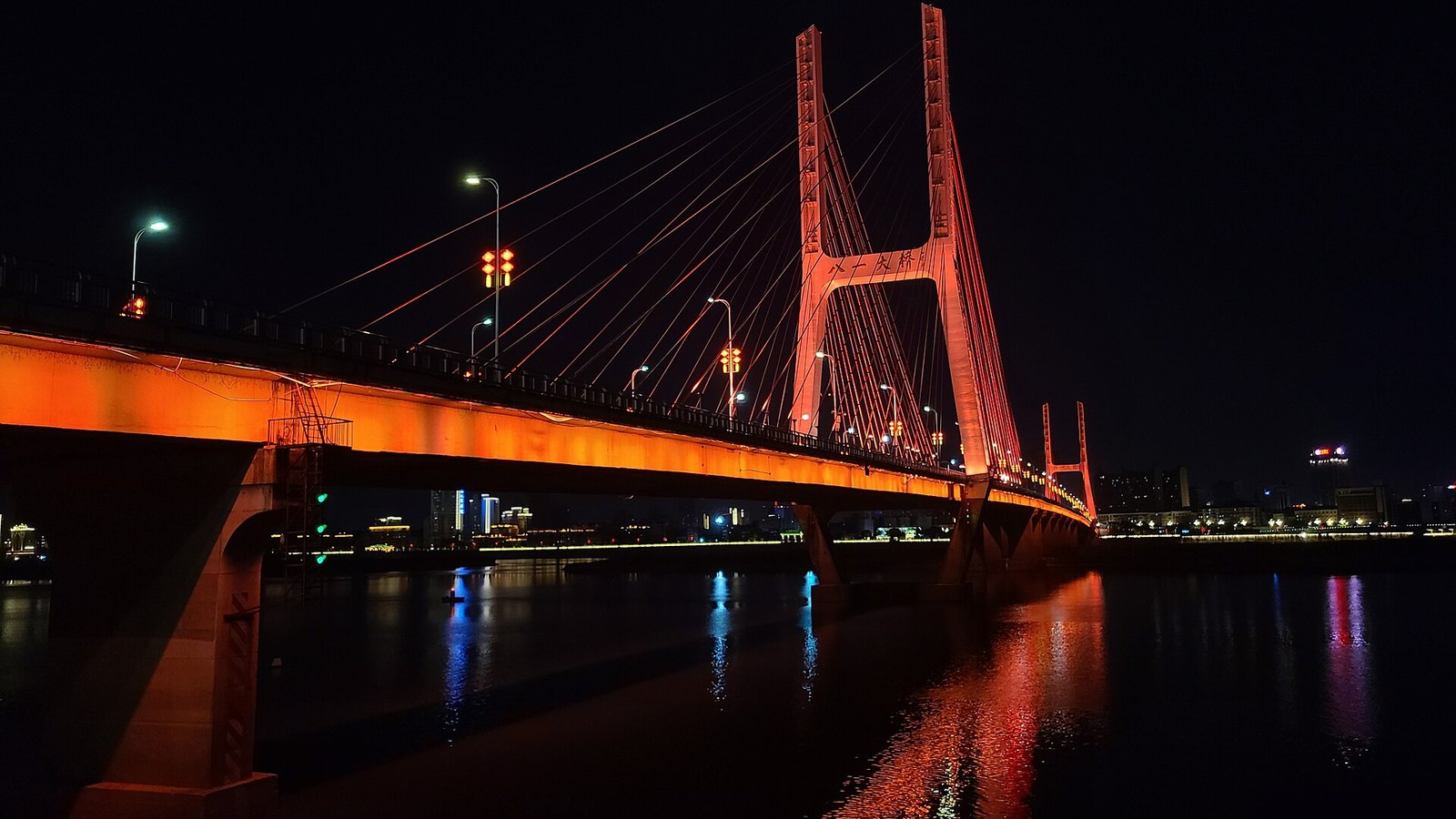
Walk out onto the east bank at Bayi Bridge and the first thing you meet is not the bridge. It's a cat. A black granite cat about the size of a minibus, up on a plinth taller than a three-storey house, one paw pinning a mouse that is clutching a copper coin. A short walk away a second cat, carved from white marble, is crouched mid-spring, as if it fancies the mouse for itself.
Nobody puts two giant cats on a bridge by accident. The Gan River (赣江) runs more than a kilometre wide past Nanchang, and the city spent ninety years learning to get over it — first with a pine-plank deck that was blown up twice, then with a cable-stayed landmark carrying a political argument in stone, and lately with arches, leaning towers and double-deckers that each stake out a decade. The bridges are the cheapest history lesson in the city: free, open at all hours, both ends on Metro Line 1.
More than a dozen road and rail crossings span the Gan inside Nanchang, and nothing on the ground tells you how they relate to each other. These are the ones worth knowing, from upstream (south) to downstream (north), so you can place everything that follows:
- Changnan Bridge (昌南大桥), 2026 — the farthest south, out past the industrial parks. A lorry route.
- Hongzhou Bridge (洪州大桥), July 2024 — suspension cables and a piece of wordplay in its towers.
- Fuxing Bridge (复兴大桥), February 2024 — a low arch about four kilometres south of Shengmi.
- Shengmi Bridge (生米大桥), 2006 — twin steel arches, the cleanest silhouette on the river, and a name that makes locals laugh.
- Chaoyang Bridge (朝阳大桥), 2015 — six slim pylons, and a sheltered walking deck underneath the traffic.
- Nanchang Bridge (南昌大桥), 1994 — the workhorse that made the west bank buildable.
- Bayi Bridge (八一大桥), 1997 — red cables, giant stone cats, the one you'll actually walk.
- Gan River Bridge (赣江大桥), 1963 — road and rail together, downstream of Bayi at Yangzizhou island.
- Hero Bridge (英雄大桥), 2009 — a pylon leaning over the water like a rifle barrel, furthest downstream.
Another, Longxing Bridge, is going in downstream of Hero for the Nanchang–Jiujiang high-speed line. We'll take them roughly in that order — but starting with Bayi, because it's the one worth an afternoon.
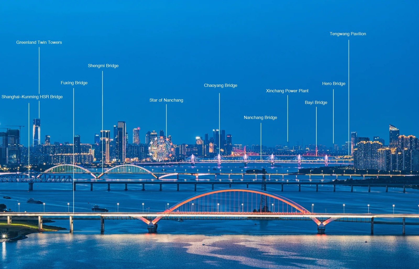
Most of the river in one frame, at blue hour from the east bank. Worth noting before you read on: the Shanghai-Kunming crossing labelled here is the dedicated high-speed line, not the 1963 road-and-rail bridge further downstream that this guide covers. And the two you should actually walk are Bayi and Chaoyang.
Before the bridges: a ferry, a general and a war
For most of Nanchang's long life there was no crossing at all. Provincial records describe passengers and freight going over by rowing boat — the current fast, the risk real — and later by steam ferry, shuttling between the old walled city and Niuhang (牛行) on the far bank, where the railway stopped. You arrived in Nanchang by train and then got in a boat.
In 1934 Jiangxi's provincial chairman, Xiong Shihui (熊式辉), set out to fix that, and named the result after his boss: Zhongzheng Bridge (中正桥), Chiang Kai-shek's given name. What opened on New Year's Day 1937 was some 1,100 metres of German steel piers and girders under a deck of imported pine, 7.92 metres wide — and the accounts recorded the cost to the last fraction of a fen: 961,960 yuan and change.
It did not last. On 26 March 1939 Chinese forces demolished eleven of its steel spans to slow the Japanese advance; in May 1949 the retreating Nationalists blew it up again. An engineer named Han Bolin (韩柏林) had traffic moving over it once more in nine days, and the provincial government renamed it Bayi Bridge (八一大桥) — "eight-one", for the 1 August 1927 Nanchang Uprising that gave the city its nickname and the army its badge. That story is written all over the city centre; see our full guide to Nanchang.
Bayi Bridge (八一大桥): the one with the cats
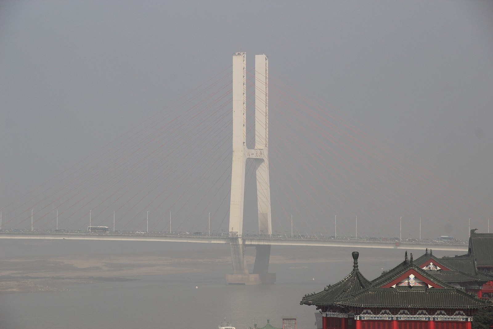
Bayi Bridge from up on Tengwang Pavilion, whose own green-tiled eaves fill the bottom corner: one of the two H-shaped pylons, the fans of red stay cable, and the four characters 八一大桥 on the crossbeam between the legs. Hazy is the default here — the cables read redder from underneath. Photo: Gary Todd / CC0 via Wikimedia Commons
The stone tablet almost nobody reads
Under the east approach of the present bridge, in a small paved square, stands a whitewashed stone pillar left from the old crossing. Set into it is a tablet dated 30 January 1957 — a piece of infrastructure writing its own obituary. It records that the old bridge was finished in the spring of 1937, that it was wrecked twice, that patch repairs kept traffic crawling across, and that the piers and deck were finally too far gone. So on 7 November 1955 they started again, finishing on the date the tablet carries: a concrete deck ten metres wide, a maximum span of 63 metres, ten metres of clearance for bigger boats, strong enough for 60-tonne tractors.
Even that was hopeless by the 1990s. In November 1995 crews began a new bridge fifty metres upstream; when it opened, the old one was blown up. Its last four piers stood in the water until 2008, when falling river levels turned them into a shipping hazard. The pillar and its tablet are all that survive — at the foot of the bridge you are about to walk on.
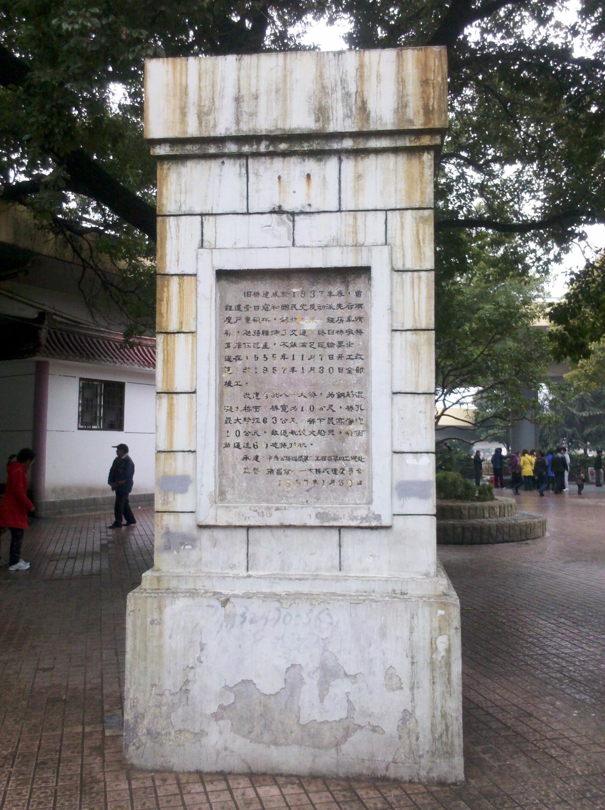
The last piece of the old bridge, in its paved square under the east approach: a whitewashed, weather-stained pillar with the 1957 tablet set into the face. Every figure in this section is carved on it — spring 1937, wrecked twice, restarted 7 November 1955, finished 30 January 1957, deck ten metres wide, maximum span 63 metres. People walk past all day without looking up. Photo: qa003qa003 / CC BY-SA 3.0 via Wikimedia Commons
The bridge you cross today
The present Bayi Bridge was the first cable-stayed bridge built in Jiangxi, and it still looks the part: two H-shaped concrete pylons 103 metres tall, 86 of those above the deck, with fans of stay cables painted a startling tomato red. The main bridge runs 1,040 metres, carried on four 160-metre main spans with shorter ones between and beyond them; with the long looping approaches the whole structure totals about 4,371 metres. Bank to bank across that main span is a little over a kilometre — about twenty minutes at a stroll, longer if you keep stopping at the parapet, which you will. The deck is 26 metres wide — four traffic lanes plus a separated lane each side for bikes, scooters and people on foot. Construction ran from 5 November 1995 to 29 September 1997, and the road opened that National Day.
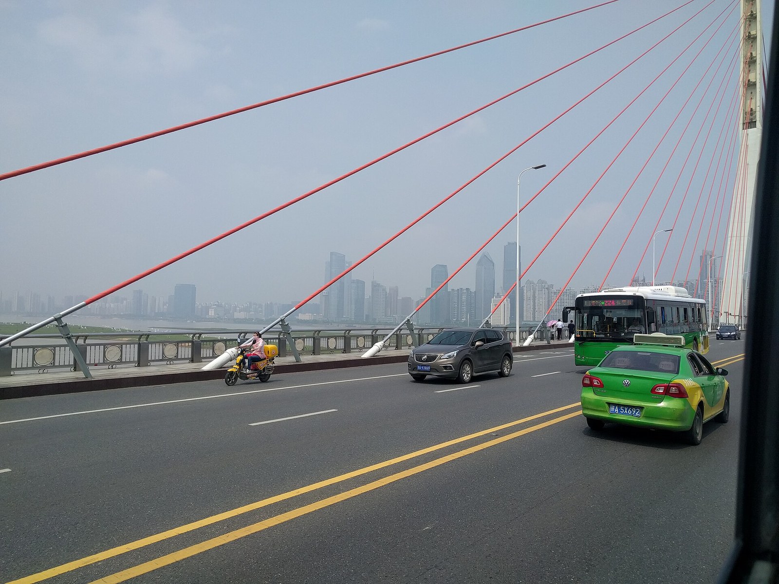
On the deck. Red stay cables raking down to their anchors just inside the balustrade, the separated non-motorised lane on the left where the scooter is, and the parapet panels with their carved roundels — the zodiac animals are in there, one per panel, and finding your own is the game. Honggutan is the smudge of towers ahead. Photo: Qa003qa003 / CC BY-SA 4.0 via Wikimedia Commons
Two things make it worth walking rather than taxiing. The parapet is not plain: its panels carry a repeating set of carved roundels of the twelve zodiac animals, so you can find your own birth year on the way across — a detail the bridge's sponsor asked for on the grounds that a bridge should belong to the people using it. And at night the pylons and deck edge are washed orange-red by a scheme running to some 5,000 lamps, with the four characters 八一大桥 glowing on the pylon crossbeam. Those characters are widely credited in Chinese reference entries to Jiang Zemin, then the country's top leader; we found no official record confirming it, so treat the attribution as local lore. The calligraphy is certainly there — running script, metres tall, best seen from the bank just downstream or from the water.
The black cat and the white cat: what's true, and what's a very good story
Here is the version a taxi driver will tell you. The bridge was nearly finished and nobody had decided what to put on the bridgeheads. A senior leader visiting from Beijing asked the Jiangxi party secretary what sculptures were planned. The secretary, whose Mandarin carried a heavy accent, answered hái mò — "not yet" — which came out sounding like hēi māo, "black cat". The leader beamed and quoted Deng Xiaoping: black cat or white cat, if it catches mice it's a good cat. And so the province, in a panic, built two enormous cats.
It is a wonderful story and almost certainly not what happened. Wu Guanzheng (吴官正), the party secretary in question, wrote about the sculptures in an essay published after he retired and collected in Xian Lai Bi Tan (闲来笔潭), and his account is flatly first-person: the idea of using cats, he writes, was his. Six months into construction he asked the project chief what was going on the bridgeheads, was told nothing had been decided, and pitched it: lions at the far end for the Hero City where the army's flag first rose, cats at the city end because "black cat or white cat" said something true about a province betting on its economy. Stone, he insisted — not concrete, not stainless steel — so they would still be there in a century.
The documented facts line up with him. The pair were designed from September 1996 and finished in May 1997, credited to Professor Zhou Shu (周曙) of Nanchang University's art and design faculty with a sculptor from Shenzhen; the white cat is white marble, the black cat black granite quarried at Fuding in Fujian; each weighs well over a hundred tonnes and had to be cut from a single block, no joins. They are not realistic, and that is deliberate: the sculptors borrowed the stylised manner of the Shang-dynasty bronze tiger excavated at Xin'gan in Jiangxi, which is why the cats read as heraldic rather than cuddly. There was a real argument too — should the white cat or the black cat hold the mouse? The single-block rule and the way the two stones catch light settled it for the black cat, and people went on arguing afterwards.
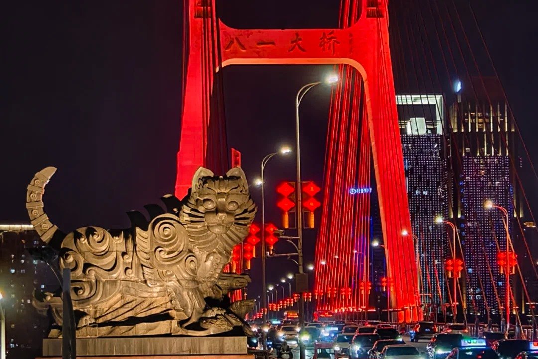
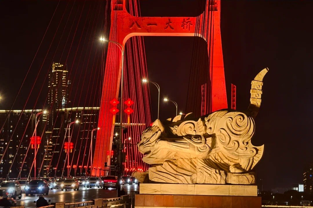
Both cats at Chinese New Year, when the deck carries lanterns and the pylons are washed red. One thing worth knowing before you plan a night shot: the floodlighting erases the single difference that matters. White marble and black granite come back the same warm cream under those lamps — we could not tell which cat is which in either of these frames, and standing there you will not either. Come in daylight if you want to see the contrast the sculptors argued over.
One footnote while you stand there. Deng Xiaoping, the man behind the cat line, spent October 1969 to February 1973 doing manual labour at a tractor repair works in what was then Xinjian County — the district at the far end of this bridge. Workers cut a gate in the factory's back wall and laid a 500-metre cinder path so he could walk to work; it is a protected site today. Wu ends his essay by suggesting the cats can stand as a memorial to him.
Lions, and four little towers
Cross to the Honggutan end and the mood changes: a pair of cast-bronze lions, glossed officially as "emancipate the mind, seek truth from facts". Chinese sources call that the north end and the cat end the south end, which baffles visitors who can see the river runs between an east bank and a west one. Go by landmarks — cats on the old-city side near Tengwang Pavilion, lions on the new-city side by Lushan South Avenue.
The strangest feature sits under the east approach, where the interchange spirals down in three tiers and four loops. Inside the loops are four small pavilions, each a replica of a famous Jiangxi building: Xunyang Tower (浔阳楼) from Jiujiang, Yugu Terrace (郁孤台) from Ganzhou, the Peony Pavilion (牡丹亭), and Longzhu Pavilion (龙珠阁) from Jingdezhen. Look rather than climb — whether any interior is open changes.
How to get up to the cats
Until recently you admired the cats from a car window. In 2024, as part of the Tengwang Pavilion scenic area's riverside expansion, the city added viewing platforms and stair towers beside both sculptures, with four pedestrian staircases along the east side of the bridge. The route in, as published by the local press when the platforms opened: from the service road on Yangming Road (阳明路), walk into the Dashiyuan North community cultural square (大士院北区社区文化广场); opposite the Yugu Terrace replica there is an underpass entrance; go straight through, take the north exit, climb the stairs, and you're at the black cat platform. Keep going north for the white cat and its own staircase. Drivers can use the Tengwang Pavilion north car park — around 130 spaces, with an exit into the same square.
Two caveats. Access changes and signage is thin: if the underpass is shut, walk up onto the deck from the riverside path and approach along the cycle lane. And come in the hour before sunset, when the cats are front-lit with the Honggutan towers behind them and you're in position for the nightly riverfront show — that has its own timings and viewpoints, covered in our guide to the Gan riverfront and the One River, Two Banks light show.
Shengmi Bridge (生米大桥): the arch, and the joke
Upstream of the centre, Shengmi Bridge breaks the run of cable-stayed towers with something the eye reads instantly: two steel-tube concrete tied arches, each spanning about 228 metres, over a 606-metre main bridge carrying eight lanes. Begun on 28 December 2003 and opened on 30 April 2006, it was the largest urban bridge on the Gan at the time, and on a clear evening the twin arches make the cleanest silhouette in the city.
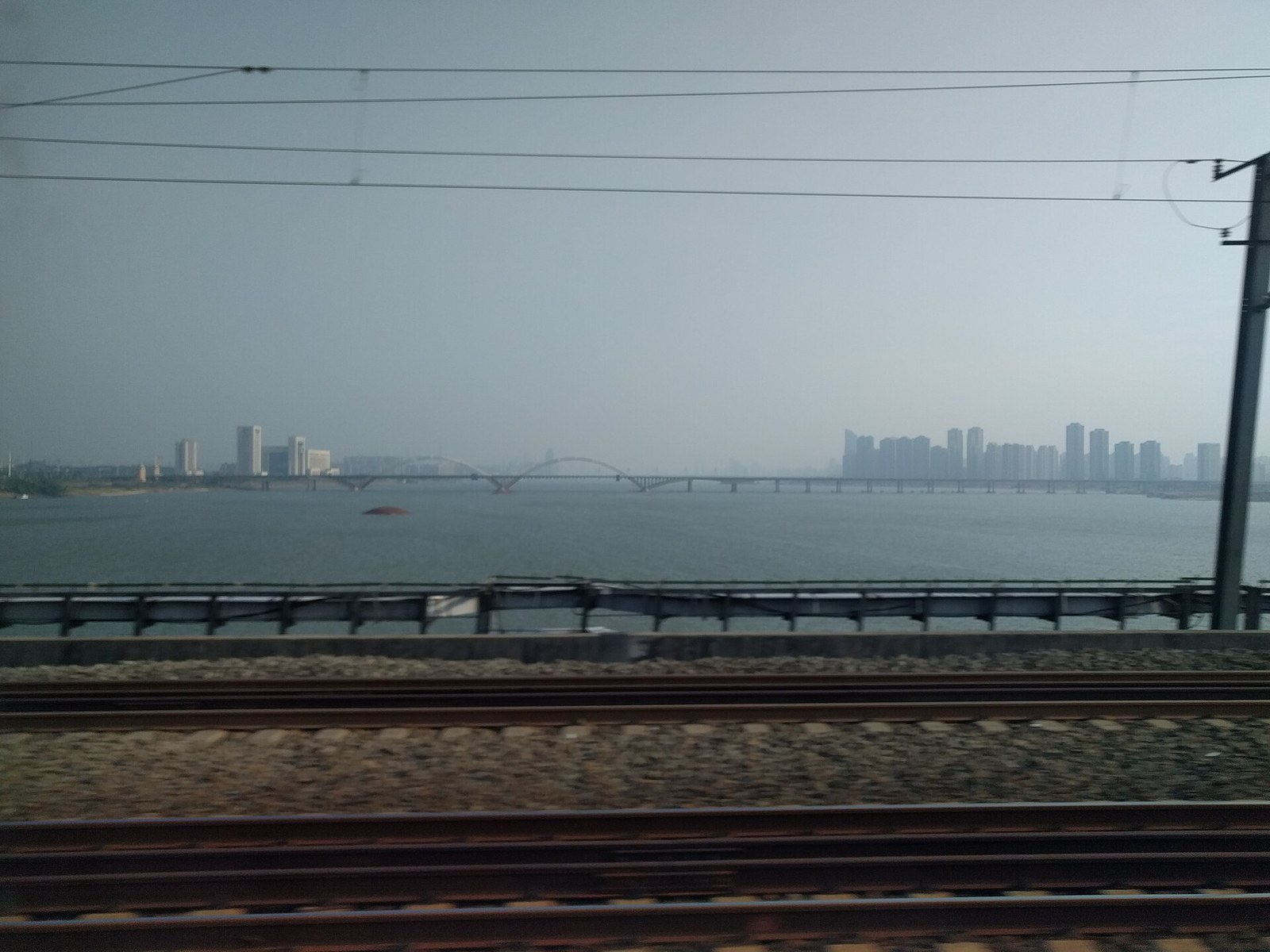
Shengmi's twin arches from a passing train on the railway crossing alongside — track, ballast and catenary in the foreground, the two arches sitting low on a kilometre of grey water, the west-bank towers behind. This is the bridge that's worth looking at even if you never set foot on it. Photo: Qa003qa003 / CC BY-SA 4.0 via Wikimedia Commons
The name is the fun part. It comes from Shengmi Town on the west bank, but the characters literally mean "raw rice" — and every Chinese speaker who reads them thinks of the idiom 生米煮成熟饭, "the raw rice has been cooked", which is what you say about a done deal. Nanchang residents have been making the joke for twenty years and have periodically petitioned to rename the thing. It remains Raw Rice Bridge.
Chaoyang Bridge (朝阳大桥): the one you can walk under cover
The next crossing downstream from Shengmi is the one to cross on foot, if you only cross one. Chaoyang Bridge was begun on 18 October 2012 and opened on 18 May 2015: six slim pylons rising 45 metres above the deck, a single plane of stays down the centre, spans of 79 + five × 150 + 79 metres over a 908-metre main bridge. Its girders use steel webs folded into a concertina rather than flat plate. Read the official boast carefully, because the version that circulates is wider than the one the builders actually make: China's first true cable-stayed bridge built with corrugated-steel-web composite girders, and the world's first bridge of that girder type to carry traffic on two decks. It is not the world's first double-decker; Chinese reports place it fifth for stacking vehicles and people on separate levels.
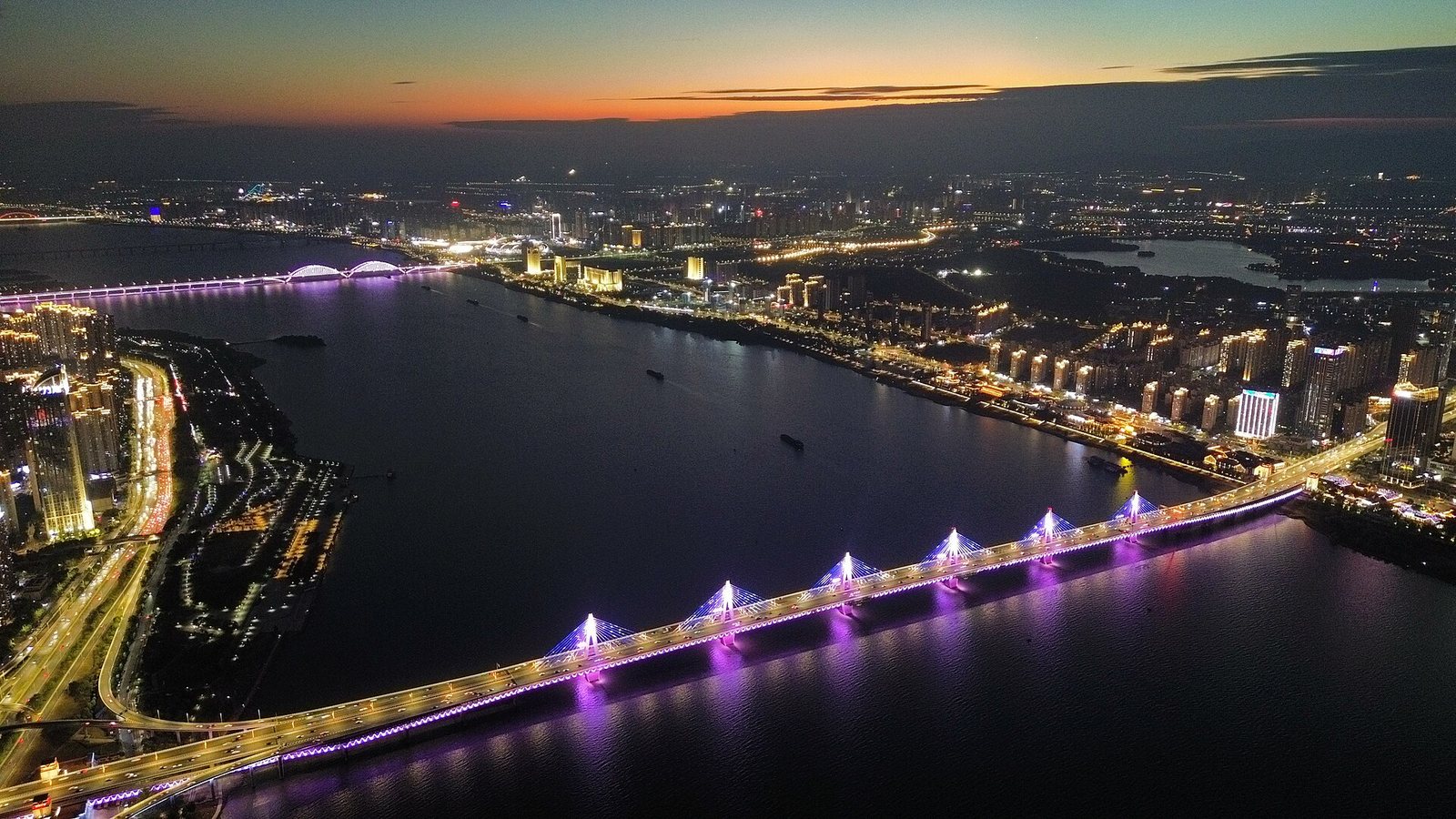
Chaoyang Bridge at dusk from the air — six slim pylons, one central plane of stays, and a lighting scheme that works through purple and blue while the last orange goes out of the sky. The walking-and-cycling level is the one you can't see from up here: it's tucked underneath the roadway, which is exactly why it's usable in July. Photo: Ddayzzz / CC BY 4.0 via Wikimedia Commons
What matters to you is the lower deck. Eight lanes of expressway run on top; underneath, sheltered from sun and rain by the roadway above, is a walking and cycling level with a two-metre footway and a four-metre bike lane on each side. Four balconies of roughly 200 square metres each hang off the sides, reached by short flights of steps, so you can stop mid-river with the water directly below. They opened to the public in August 2015. It is one of the pleasantest free hours in Nanchang and almost no visitor knows it exists — come late afternoon, and check the street-level ramps before committing, because maintenance closures happen.
Nanchang Bridge (南昌大桥): the double-decker that built a new city
Downstream of Chaoyang and still upstream of the old town, Nanchang Bridge is the crossing that changed the map. Begun in August 1989 with a World Bank loan and opened on 10 January 1994, it is described in Chinese sources as the country's first urban highway bridge to separate traffic vertically across two decks — cars above, bikes and pedestrians below. The main bridge runs 992.59 metres over thirteen navigation openings, eleven of them 80-metre clear spans.
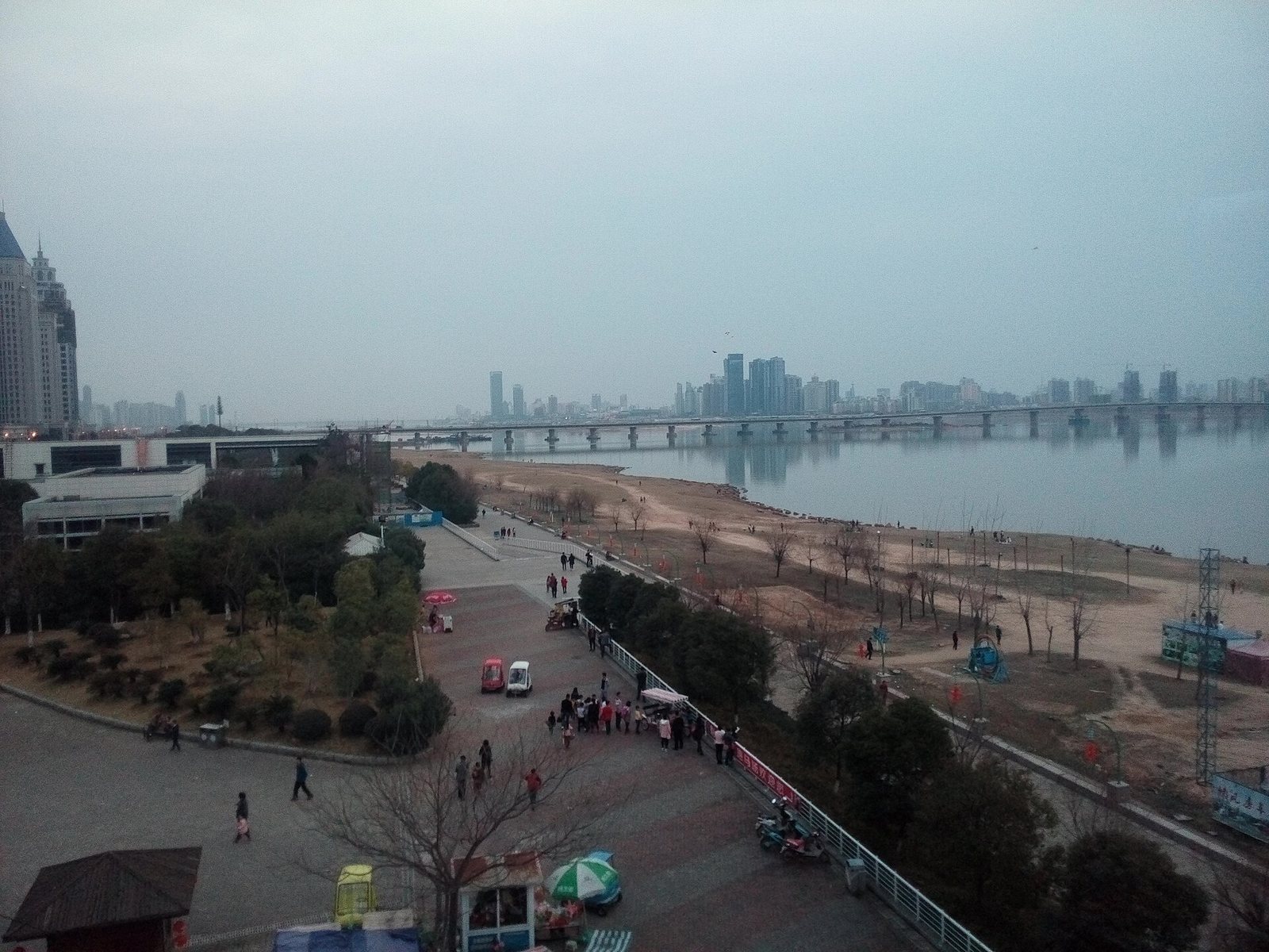
Nanchang Bridge from the embankment park on the east bank: a long low line of piers rather than a landmark, with the Honggutan towers it helped make possible hazy behind it. In low water the sand comes out and the whole foreshore turns into a beach people wander about on. The bikes-and-pedestrians deck is underneath, invisible from here. Photo: Qa003qa003 / CC BY-SA 4.0 via Wikimedia Commons
Its real significance is what it unlocked. Until the 1990s "Nanchang" meant the east bank; the west was farmland and villages. Nanchang Bridge in 1994 and Bayi Bridge in 1997 landed within three years of each other, and the towers of Honggutan went up behind them. Every skyline photograph you take in this city is a consequence of those two decisions.
Gan River Bridge (赣江大桥): where the trains cross
Past Bayi, the oldest crossing still standing is not glamorous, and that is the point. Work started on 30 September 1958 and it opened on 10 January 1963 — road and rail combined, railway down the middle, a two-lane carriageway each side. Because the river splits around the sandbar island of Yangzizhou here, it is really two bridges: 662.68 metres from the east bank to the island, 565.01 metres from the island to the west. Trains on the Shanghai–Kunming and Beijing–Kowloon lines still rumble over it.
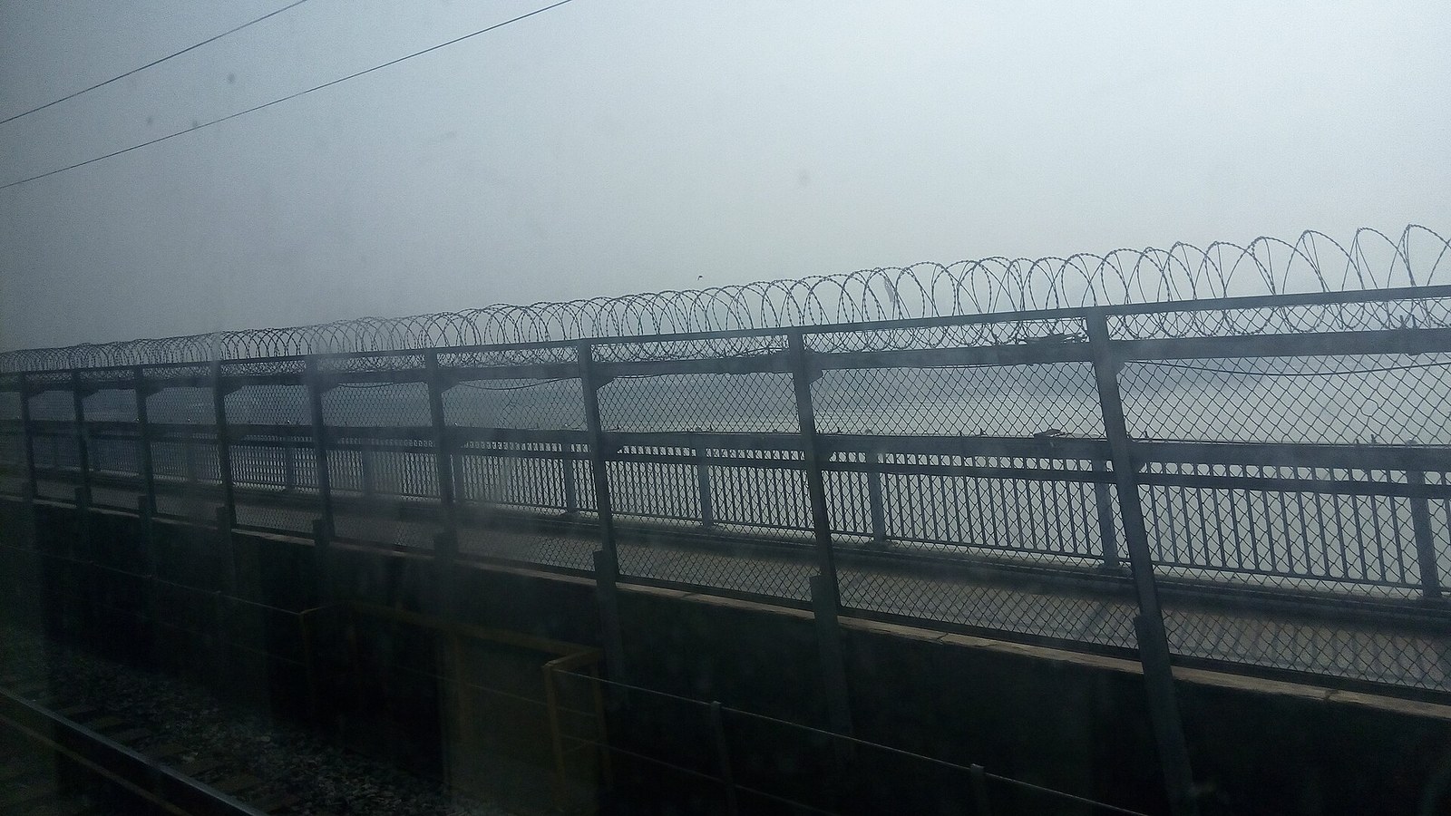
The 1963 crossing from a train window, which is how most people see it: ballasted track in the foreground, a chain-link fence topped with coils of razor wire, and the road carriageway immediately beyond — road and rail sharing one structure, a metre and a fence apart. Nothing about it is pretty, and that's the appeal. Photo: Qa003qa003 / CC BY-SA 4.0 via Wikimedia Commons
If you like industrial romance more than architecture, this is your bridge: rivets, green girders, a sandbar of vegetable plots, a freight train crawling over water the colour of weak tea. It is well away from the tourist strip, so go only if that sentence made you happy.
Hero Bridge (英雄大桥): the leaning tower
Further downstream, past Yangzizhou, is the most theatrical bridge in Nanchang and the one visitors almost never see. Hero Bridge began in October 2006 and opened on 28 February 2009, and because it too crosses both channels around the island it comes in two halves with two structural systems. The northern half is cable-stayed, with a single pylon 131.23 metres tall raked over at 79 degrees — its designers describe it as a sword, a rifle barrel and a spiral staircase at once, standing for the first shot of the 1927 uprising. The southern half is a self-anchored suspension bridge with a 195-metre main span, and its brief was gentler: yúzhōu chàng wǎn, "fishing boats singing at dusk", lifted from Wang Bo's seventh-century preface written a few kilometres upstream at Tengwang Pavilion. One bridge, two moods, 1,300 years apart.
The halves went up under different names — the southern one was originally Hongdu Bridge — and were unified in November 2009. There is no reason to walk it; it is a photograph, best taken from the east bank.
The newer crossings, and the tunnel that isn't a bridge
Nanchang has not stopped building. Four of the newest crossings are worth a second line:
- Fuxing Bridge (复兴大桥), main line opened February 2024 — a half-through tied arch with a 268-metre span and a ribbon-like profile; its walking and cycling routes are pulled clear of the traffic entirely, which its engineers claim as a domestic first for an arch bridge.
- Hongzhou Bridge (洪州大桥), opened 1 July 2024 — a self-anchored suspension bridge whose gate towers are shaped into the character 昌, the "chang" in Nanchang.
- Changnan Bridge (昌南大桥), opened early 2026 — 3,852 metres out among the freight terminals, a logistics link rather than a sight.
- Longxing Bridge (隆兴大桥) — built for the Nanchang–Jiujiang high-speed railway with harp-shaped stays and a 320-metre main span, stacking eight lanes of road above a double-track railway. Check locally whether it is carrying trains yet.
Then there is the crossing nobody photographs. Honggu Tunnel (红谷隧道) opened on 7 July 2017: 2,650 metres of dual three-lane roadway, of which 1,329 metres is an immersed tube built from twelve sunk concrete elements, billed as the largest inland-river immersed-tube tunnel in China. It gets you under the Gan in about three minutes. Metro Line 1 got there first, in 2015: its bored section from Qiushui Square across to Tengwang Pavilion is described locally as the first tunnel beneath the Gan, and it is still the quickest hop from bank to bank — see our Nanchang metro guide for tickets and timings.
A 90-minute bridge walk on the east bank
- Surface at Tengwang Pavilion station (滕王阁站), Metro Line 1, and walk to the river. Exit 4 comes up on Yanjiang Central Avenue (沿江中大道), the road that runs along the water — that's the one you want. Exit 2 is the one signed for the pavilion itself, about 1.1 km to its south gate. Numbering gets reshuffled, so follow the boards naming 沿江中大道 or 滕王阁 rather than a digit. The pavilion deserves its own half-day — see our Tengwang Pavilion guide — but for this walk you want the embankment beside it, looking north.
- Walk north along the riverside path, ten minutes or so. Bayi Bridge grows in front of you the whole way: red stay cables, Honggutan stacked behind.
- Find the old bridgehead pillar and its 1957 tablet in the square under the east approach, then loop through the four pavilion replicas inside the interchange.
- Go up to the black cat, then the white cat via the underpass and stairs from the Dashiyuan North community square. Shoot from below for scale, from the platform for the skyline behind.
- Walk out onto the deck in the separated side lane. It's a little over a kilometre bank to bank — twenty minutes without stopping, half an hour the way people actually do it. Find your zodiac animal in the parapet roundels; pause halfway for the widest river view in the city.
- Finish at the far end for the bronze lions, then walk down into Honggutan for dinner or ride Line 1 back under the river. Stay for dusk if you can — the whole riverfront switches on.
Reversing it works too, and is better in summer: start on the west bank in shade and cross into the sunset. For more framing ideas across the city, see our Nanchang photo spots guide.
Practical notes
- Getting there. Metro Line 1 serves both ends — Tengwang Pavilion station for the cats and the old-town side (Exit 4 for the riverside road, Exit 2 for the pavilion), Lushan South Avenue or Qiushui Square (Exit 5 for the waterfront) for Honggutan. Lushan South Avenue was going to be called Bayi Bridge West until the stations were renamed in 2015, which tells you how close it is.
- Cost. Nothing — every bridge, platform, tablet and pavilion replica here is free and outdoors.
- How long. Cats, old pillar and a crossing: 90 minutes to two hours, of which the deck itself is about twenty minutes each way. Chaoyang Bridge's lower deck is a separate outing of about an hour.
- Best time. The hour before sunset, then stay for the lights. Midday in July and August is brutal on an open deck with no shade.
- What to skip. Don't try to see them all. Bayi and Chaoyang reward a visit on foot; Nanchang Bridge and Shengmi Bridge are worth looking at from the bank; the rest are motorway structures with nothing at either end.
- On the deck. Stay in the marked non-motorised lane; scooter traffic moves fast and almost silently. Expect wind even on still days.
If you'd rather have all of this — the cats, the tablet, Chaoyang's covered deck, dinner timed to the riverfront lights — arranged around your dates instead of your map app, we build custom Nanchang and Jiangxi itineraries: plan your trip with us.
FAQ: Nanchang's Gan River bridges
Are the black cat and white cat sculptures real, and can you get close? Entirely real: two stone cats, each over a hundred tonnes, at the old-city end of Bayi Bridge since 1997. Since 2024 there have been viewing platforms and staircases beside both, reached from the Dashiyuan North community square via an underpass. Access can change — follow the signs.
Did a misheard dialect word really cause the cat sculptures? Almost certainly not. The story — a leader mishearing "not yet" as "black cat" — is repeated all over Nanchang, but the province's party secretary at the time, Wu Guanzheng, later published an essay saying the concept was his own and describing how he proposed it. Enjoy the story; know it's folklore.
Who wrote the calligraphy on Bayi Bridge? The four characters 八一大桥 sit on the crossbeam of the main pylon, visible from the riverbank and the water. Chinese reference entries widely credit them to Jiang Zemin, then general secretary, but we could not verify that against an official source — so treat it as unconfirmed local lore rather than fact.
Can you walk across the bridges in Nanchang? Yes, on several. Bayi Bridge has a separated non-motorised lane each side plus stair access at the east end. Chaoyang Bridge has a dedicated lower deck for walkers and cyclists with four viewing balconies. Nanchang Bridge puts bikes and pedestrians on its lower level. The motorway-standard crossings further out do not invite walking.
Which Nanchang bridge is best for photos? Bayi Bridge — red cables, cats, skyline behind — shot in the hour before dark from the east bank or the platforms. Shengmi Bridge gives the cleanest silhouette; for the river rather than a bridge, use Chaoyang's lower-deck balconies.
How many bridges cross the Gan River at Nanchang? More than a dozen, and the number keeps rising — road bridges, a combined road-and-rail bridge, a road tunnel and a metro tunnel, with more under construction. Only a handful interest a visitor; those are the ones above.
Before you go
Bridges change more slowly than restaurants, but the things around them don't: platform access, stair closures, whether a pavilion replica is open, and which of the newest crossings is carrying traffic can all shift between visits. Check the signs on the day.
Last verified: 2026-08 — access arrangements, construction status and opening details change; please double-check locally before you travel.
You Might Also Like
- Why Visit Jiangxi? China's Underrated Gem
- Nanchang: Your Gateway to All of Jiangxi
- Nanchang Fireworks: When & Where to Watch
Explore Nanchang & Jiangxi itineraries · Plan a custom trip with us