Meiling: Nanchang's Cool Mountain Escape
Meiling is Nanchang's back garden — 8–10°C cooler, 40 minutes from Bayi Square. Cableway, rafting, Panlong Peak, trails, costs and how to plan a day.
By Hello Nanchang · Last updated
Meiling (梅岭), Wanli, Xinjian District, Nanchang, Jiangxi · Year-round; best June–September as a heat escape, and spring for the trails
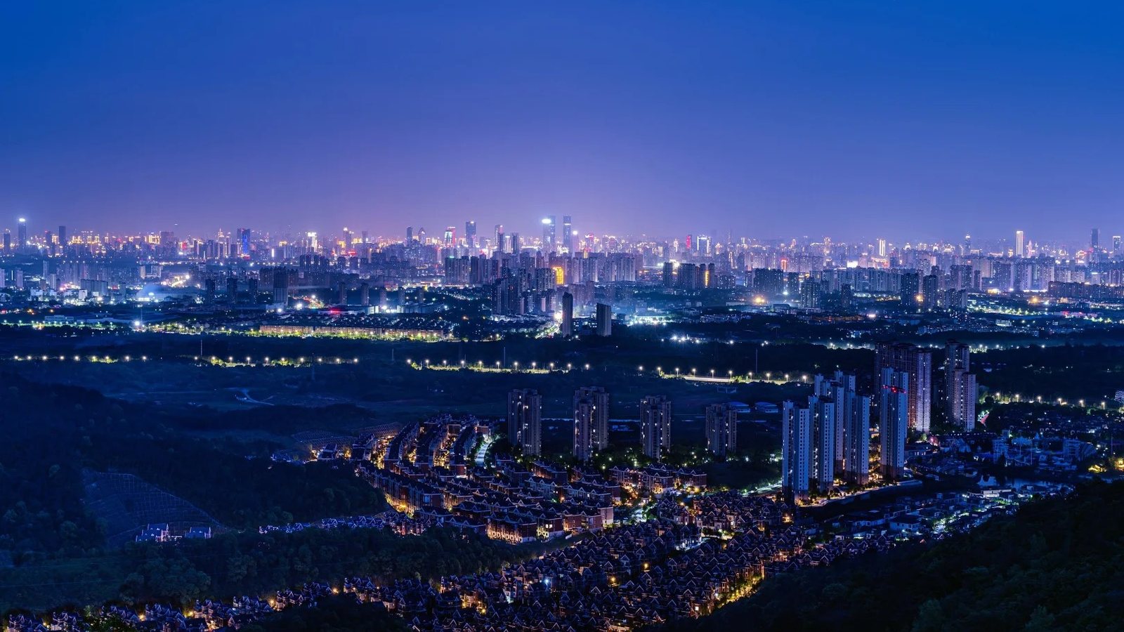
By mid-July, Nanchang stops pretending. The pavement throws the heat back at you, the plastic stools outside the noodle shops stay empty until nine at night, and the city that keeps turning up on China's "furnace" lists gets on with the business of being one. Locals have had the same fix for two thousand years, and it isn't a shopping mall. It's altitude.
Meiling (梅岭) isn't a distant attraction you bolt onto a Jiangxi trip. It's Nanchang's back garden and its air-conditioning — a long green wall of bamboo, granite and tea terraces starting about 29 km northwest of Bayi Square, topping out around 841 m, running a reliable 8–10°C cooler than the streets you left. When the city is pushing 38°C in August, the ridge sits at a summer average near 22.6°C: the difference between a T-shirt and reaching for a jacket, forty minutes from downtown. Our guide to Nanchang's countryside day trips maps the whole ring of villages, lakes and farms around the city; this page goes deep on the one direction most visitors actually have time for.
The shape of it, before the history:
- Getting up there: about 40 minutes from downtown by car; metro to Ditie Dasha, then a bus and the cableway if you don't have one.
- The point of going: 8–10°C cooler than the city, and a summit summer average around 22.6°C.
- What it costs: the range itself is free — road, bamboo, villages, most trails. The individual pockets run from about ¥15 to ¥90; the cableway is the big item at ¥130 return.
- How long: half a day minimum for the cableway and the summit belt; a full day if you want two pockets.
- When: midweek. At weekends half of Nanchang drives up here and the switchback road behaves accordingly.
Why this ridge matters to Nanchang
Nanchang is hot for structural reasons — an inland basin, hills at a distance holding the summer air still, a wide river that keeps the heat and the humidity in overnight — and there's nowhere in the city to escape it. Which is why the mountains on its northwestern edge became, over centuries, less a scenic area than a civic utility.
Get the geography straight, because signs will tell you different things. Meiling National Forest Park covers roughly 111 sq km. The wider Meiling–Tengwang Pavilion National Scenic Area, approved by China's State Council in the fifth national batch, is quoted at about 150 sq km and — oddly and rather wonderfully — formally includes Tengwang Pavilion (滕王阁) down on the riverfront in the same designated landscape. Nanchang's most famous building and its highest hill are legally one place; read on for why. One administrative snag: everyone still calls this area Wanli (湾里), some 230 sq km of almost pure hill country with 120-odd scenic spots and 19 open scenic areas. The old Wanli District was abolished and folded into Xinjian District (新建区), now run day-to-day by the Wanli Management Bureau — but every map app, taxi driver and booking site still says Wanli. Type Wanli.
The oldest story in Nanchang is up here
Most cities keep their founding myth in a museum. Nanchang keeps its in a ravine.
On a wooded slope at the eastern foot of the range sits Hongya Danjing (洪崖丹井), "Hongya's cinnabar wells" — the oldest of the classical Ten Sights of Yuzhang. The legend: Linglun (伶伦), music minister to the Yellow Emperor and, by tradition, the man who cut the first bamboo pitch-pipes and fixed the twelve tones of the Chinese scale, retired here as the hermit Master Hongya and sank five wells for water pure enough to refine elixirs with. Unprovable — but the consequence is concrete. In 589, when the Sui reorganised the empire, the old Yuzhang commandery was renamed Hongzhou (洪州) after this cliff. Hongzhou became Hongdu (洪都) — still what Nanchang calls itself on street signs, in company names, and in the opening line of the most famous prose ever written about the city, Wang Bo's Preface to the Tengwang Pavilion: "Yuzhang, the old commandery; Hongdu, the new prefecture." The city's second name comes from a ravine an hour's bus ride away, named for a musician who probably never existed.
There's more here than the story. The cliff carries a run of moya rock inscriptions, one cut in the winter of 1185 and still legible — travellers signing the mountain's guestbook eight hundred years ago — and the site has been a provincial protected relic since the 1980s. The spring below the falls was ranked "the eighth-finest under heaven" in the old connoisseurs' league table of waters; Ouyang Xiu is said to have drunk tea brewed with it at Cuiyan Temple (翠岩禅寺), still standing on the same trail, and called the combination unbeatable. The loop linking the falls, the wells, the Leshen Palace (乐神宫, built for the god of music) and the temple runs about 3 km and takes two to three unhurried hours — the easiest serious thing to do on the mountain.
The man the mountain is named after
Meiling wasn't always Meiling. The hill was Feihong Shan (飞鸿山), crossed by a post road as early as the Han. In the last years of the Western Han, a Nanchang county officer named Mei Fu (梅福) — who had spent his career filing memorials nobody wanted to read — gave up on Wang Mang's takeover of the court, walked out and disappeared into these hills. He was never satisfactorily accounted for again. Local people built an altar to him on the ridge, a shrine at its foot, and renamed the mountain after him. Meiling means, roughly, "Mei's ridge": a city named its skyline after a mid-ranking civil servant who quit on principle, and it stuck for two thousand years.
The Daoists came next, in numbers. Daoist geography counts these hills as the twelfth of the thirty-six lesser grotto-heavens, and at its peak the range is said to have held 136 temples and shrines. This is the cradle of the Jingming (净明) school, whose patriarch Xu Xun (许逊, 239–374) is among the most-worshipped figures in Jiangxi. His mother temple, Xishan Wanshou Palace (西山万寿宫), founded in 376, sits at the southern end of the same scenic area in Xishan town — a separate trip, and not the same thing as the Wanshou Palace lane district downtown, a restored shopping-and-snacking quarter with the same name. Two Wanshou Palaces, an hour apart, both real.
Why the lake at the top is called "washing herbs"
The high point of the range is a small lake on the shoulder of Luohan Ridge called Xiyao Lake (洗药湖) — "herb-washing lake" — roughly 841 m up and the highest ground in Nanchang. The name is credited to Li Shizhen, said to have brought his students here to gather plants while compiling the Bencao Gangmu, China's great Ming pharmacopoeia, and to have rinsed the day's haul in this water. Villagers had an earthier version: the foot-washing hollow, after the limping immortal Iron-Crutch Li soaking his bad leg in it. In the mid-1980s the local government built a summer resort up here on purpose, and the ridge now carries guesthouses running to a thousand-plus beds, filled every July and August by Nanchang families doing what Mei Fu did for entirely different reasons. Tourism copy nicknames the range "Little Lushan" (小庐山). Lushan is grander — but Lushan is an expedition, and this is a bus ride.
The six pieces of Meiling worth knowing
Meiling is not one gated park. It's a mountain range with a road up it, and the paid attractions are small pockets strung along that road. Knowing which pocket is which is the whole planning problem.
- The summit belt — Xiyao Lake (洗药湖) and Tianjing Lake (天净湖). Cool air, high tea gardens, the guesthouses, the cableway's top station. Gentle walking on made paths; big views on clear days, cloud and nothing at all on bad ones. This is where you go to be cold in August.
- Lion Peak (狮子峰) — the steep, fun end. Nowhere near the ridge's high ground but genuinely sharp: crags, granite boulder fields, a mini "one-line sky" cleft, the Wangshi Ravine waterfall (望狮涧), a boardwalk pinned to the rock, and a chain suspension bridge local listings bill as Jiangxi's longest. A bolt-on adventure park — cliff swing, glass slide — pulls in families alongside hikers.
- Shenlong Pool (神龙潭) — water, shade, low effort. A valley of linked falls and plunge pools deep in the range: the main Shenlong falls, Tiger's-Roar spring, the stacked "pool above a pool". Upstream at Zimu hamlet (梓木自然村) stand three yews reckoned a thousand years old, up to 26 m tall with trunks over a metre thick.
- Hongya Danjing (洪崖丹井) — the history end, above. Low, close to the city, walkable, and the one section where the story outruns the scenery.
- Mopanshan Forest Park (磨盘山森林公园) — free, and in town. Fifty hectares mid-valley with a 10.59 km forest walkway — 4.85 km of it steel-frame boardwalk in the air — billed as Jiangxi's longest urban forest trail, wired with smart lamp-posts that read out your distance and pace. There's a 2–3 km highlight section if you don't want the lot. Free, and right beside the cableway base: the best "we have two spare hours" option here.
- Taiping (太平镇) — the valley base camp. Not a sight; a place to eat and sleep. The Taiping Xinjie (太平心街) strip holds the restaurants and guesthouses, with courtyard inns behind it, and along the same valley the Jiangxi Ming and Qing Dwellings Park (江西明清古民居博览园) — ten genuine Ming and Qing houses lifted from across the province and rebuilt here, plus sixteen replicas. Priciest single ticket up here; a good rainy afternoon if you like old Jiangxi carpentry.
Two more sit outside that list. Tongyuan Gorge (铜源峡) is a bamboo canyon on the Wanli–Xinjian boundary, credited in local listings with 300-plus old water-powered mills and 80-odd waterfalls down a 600 m drop — the least developed thing here, an explore rather than a tick, and it wants a car and some patience. Panlong Peak (蟠龙峰) wants neither, and has earned its own section below.
Panlong Peak (蟠龙峰): where Nanchang goes to look at Nanchang
This one is new enough that the guidebooks haven't caught up. Panlong Peak sits at the southern gateway of the range — the last hill before the city starts — and only opened as a managed scenic area in early 2024. It is now where the city goes to photograph itself.
The numbers explain why it works. Its high point, Shigu Peak (石鼓峰), is only about 340 m: nowhere near Xiyao Lake's 841 m, and that is exactly the point. You are close in rather than high up, so the city fills the frame instead of sitting on the horizon as a grey smudge. The scenic area covers over 900 hectares of ridge and forest — named for a spine of hills that coils like a dragon — and local write-ups put it about fifteen minutes' drive from the administrative centre in Honggutan. Four decks are strung along the ridge road: Jipo'nao (鸡婆垴), Touliangsha (透凉沙), Fenglinjian (枫林尖) and Panlongding (蟠龙顶). The boardwalk at Jipo'nao and the deck at Touliangsha are the two that show up in everyone else's photos.
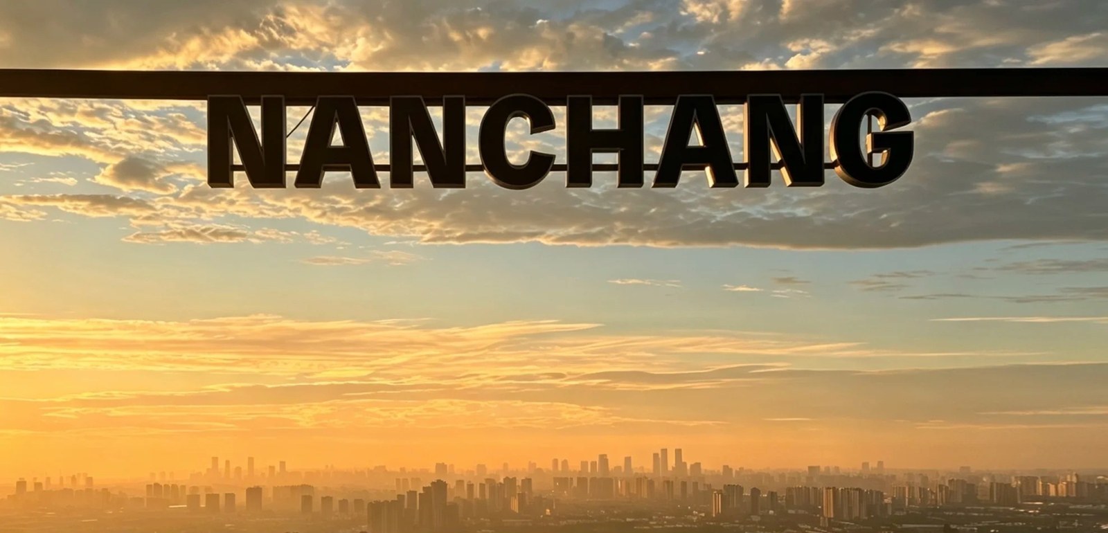
Dawn from the Panlong Peak deck: the city stacked in flat grey layers along the horizon under an orange-gold sky, with the deck's NANCHANG sign going to silhouette in front of it. Everyone shoots the letters; the layers are the better picture.
What you get is two different views at two different hours, and they're worth two separate trips if you can face the alarm. At sunrise the sun comes up behind the city, the plain fills with gold haze, and the towers reduce to flat stacked bands. The deck's other feature is a run of black three-dimensional NANCHANG letters bolted along the rail, which is what half the people up there at six in the morning are actually queueing for. After dark you get the other version: the skyline welded into one continuous strip of light, with the villa roofs and tree line of the lower slopes black in the foreground. On a clear day you can pick Tengwang Pavilion out across the Gan — and turn round, and the wooded ridges behind you are Xishan jicui (西山积翠), "massed emerald of the western hills", another of the same classical Ten Sights of Yuzhang that gave us Hongya Danjing. Two of the ten from one car park.
Practicalities are thin, and we'd rather say so than guess. This is a drive-up viewpoint on a ridge road — self-drive, Didi or a hired car — and we could not find a published gate price or opening hours for the decks, so treat it as open hillside and confirm on the day rather than budgeting for a ticket that may not exist. There's no metro and no bus route we can vouch for. Bring a longer lens than feels necessary: the towers are a long way off and summer heat haze eats them by mid-morning, which is one more argument for dawn. And if you're setting an alarm in the dark for it, have your guesthouse check the ridge road isn't shut for works first.
Pick your day: four routes that work
1. The lazy win — half a day, no hiking, no car
- Metro Line 1 or Line 2 to Ditie Dasha (地铁大厦), where the two lines interchange in Honggutan — a 40-metre walk between platforms. (New to the system? Our Nanchang metro guide covers QR tickets and last trains.)
- Bus 712 or 699 to Wanli Cableway Station (湾里索道站), 66 Shangren Street. Both start at Ditie Dasha; 712 exists essentially to do this job.
- Ride up. The cableway runs 5,580 m end to end and lands you at Tianjing Lake, 760 m, in about sixteen to seventeen minutes, with a mid-station on the way. You watch the tower blocks fall away and the bamboo close in.
- Walk the summit belt. From the top station the ground is gentle. The Xiyao Lake loop is about 6 km and 2.5–3 hours past the high tea gardens, the old forest fire-watch tower and Luohan Ridge; cut it short anywhere and just sit in the cold air with a tea.
Staying near the riverfront? Neater still: the Y531 tourist bus links Tengwang Pavilion directly to the Wanli morning-liquor market, putting the city's headline monument and the mountain's strangest breakfast on one ticket.
2. The classic full day, with a car
Morning at Hongya Danjing — the 3 km loop early, before the tour groups, while the ravine still has mist in it and the 1185 inscription catches side light. Up to Taiping for a long lunch of bamboo and clay-pot chicken. Afternoon: pick one of Lion Peak (to sweat) or Shenlong Pool (for shade and water). Finish on Panlong Peak or the summit belt for sunset. Don't add a fourth stop — driving between pockets eats more time than you expect, and the road is all switchbacks.
3. The hiker's day — the trails, by numbers
Wanli has signed and published a proper trail network, which is unusual and very welcome. Pick by ability, not by name:
- Lion Peak short loop — 5 km from Panxi village, 2–3 hrs, easy-moderate: bamboo path, cleft, summit, ravine waterfall, hanging boardwalk. Best first hike here.
- Lanxi Valley path — 2 km, 1 hr, easy. Shenlong Pool down to Tuanshan village past the thousand-year yews.
- Honghe Valley — 3 km return, 1.5 hrs, easy; or the full traverse to the Xiyao Lake tea gardens, 6.6 km, 2 hrs, moderate, past the Fairy Altar and Immortal's Cave.
- Xiyao Lake loop — 6 km, 2.5–3 hrs, moderate, from the summit lodge at 841 m. Do this one for the views.
- Leigongjian circuit — 6.8 km, 2.5–3 hrs, moderate, out and back from Shangping old village over a 586 m top, past a reservoir and hill tea.
- Moon Bay loop — 7.8 km, 3 hrs, easy, from Dongxi village: thousand-year chinquapin woods and a stretch of post road dated to 1725. Gentle enough for kids and grandparents.
- Zhuhai Mingzhu ("Bamboo Sea Pearl") — 8 km return, 4 hrs, hard. Named rocks — Yue Fei's sword-testing stone, the Turtle, the Elephant King — and the 841 m main summit.
- Old-and-New Four Slopes — 14.1 km, 4–5 hrs, hard, long sections of unstepped dirt; third slope longest, fourth steepest.
- Lion Peak long line — 22.03 km, ~8 hrs, hard. Out-and-back from the Lion Peak bus stop over Mo Shan and Da Shinao. Start at dawn.
4. With kids, or anyone who doesn't want to climb
Cableway up, gentle summit walking, cableway down — that's the spine. Add Mopanshan's boardwalk (free, flat, shaded, and the smart lamp-posts are a hit with children) and either the Moon Bay loop or the Lanxi Valley path for a real but easy forest walk. In summer the Meiling rafting run (梅岭漂流) is the one thing teenagers will rank above their phones — but it's 2.5 to 3 hours on the water, so it is the afternoon, not an add-on. Younger children do better in the shallows than on the raft — see Summer water, below, for the streamside canopies. Skip the long trails and Tongyuan Gorge, and don't take a toddler up Lion Peak's upper scramble — it's steep and slick when wet.
Getting there
By cableway — best for most visitors without a car. Metro Line 1 or 2 to Ditie Dasha, then bus 712 or 699 to Wanli Cableway Station, 66 Shangren Street, next door to Mopanshan Forest Park. Standard fares have been published at ¥80 up, ¥70 down, ¥130 return, with discounted promotional pricing (around ¥100 return) run at various points, so check what's actually on sale; concessions cover children by height, students, over-65s, military and people with disabilities, and small children ride free. Buy through the operator's WeChat service account, a booking platform, or the lower-station hall. It shuts for high wind, storms and maintenance, sometimes for days at a time — ring the enquiry line on 0791-83780900 and confirm the day's first and last cars (0791-83780600 is the complaints line, staffed 9am–5pm, and no use for this) before you build a sunset around it. Search 梅岭云端索道 in Amap (高德) rather than trusting a metro exit number; they shift with roadworks.
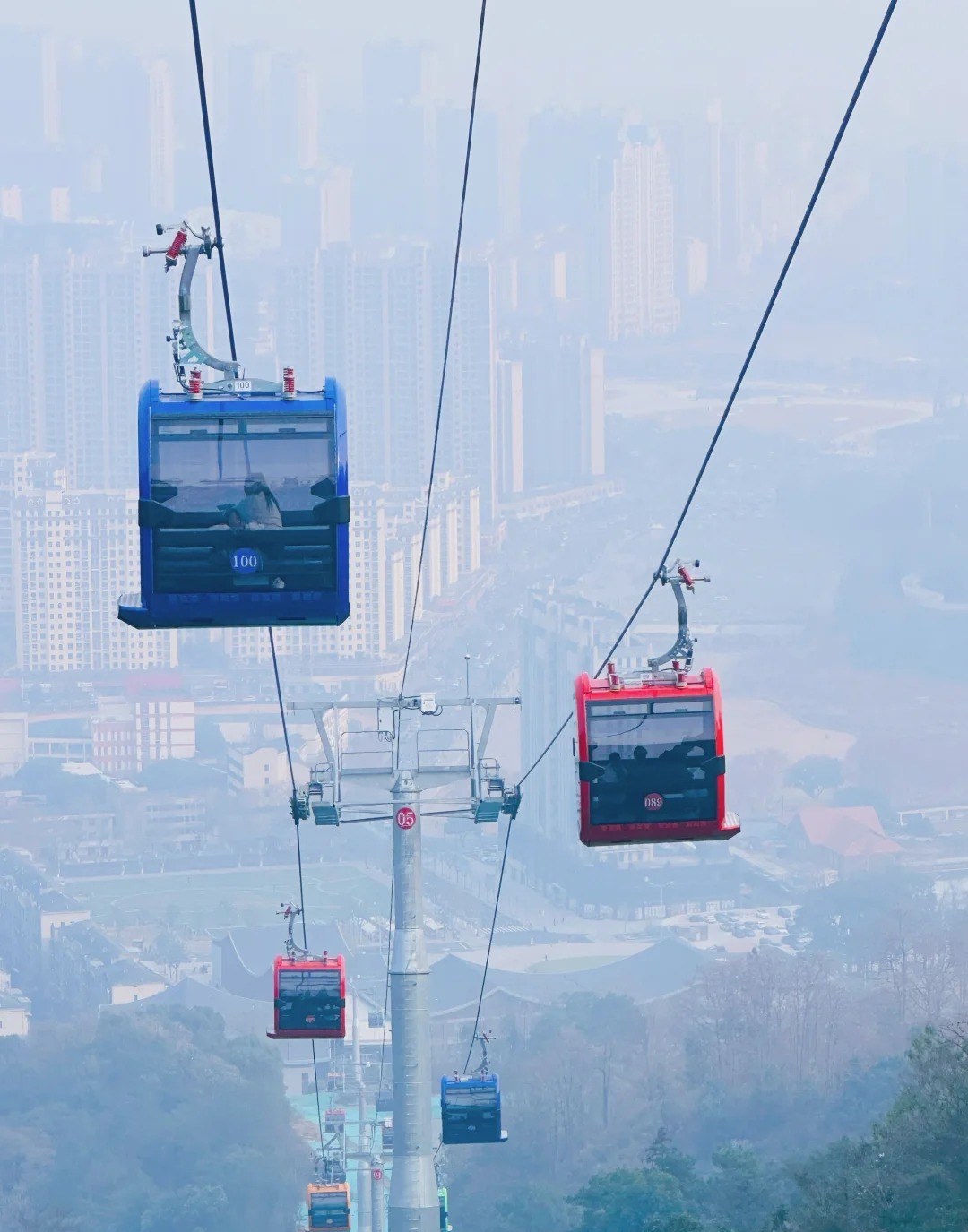
Cabin 100 going up, cabin 089 coming down, over tower 05 — and the whole of northwest Nanchang dissolving into haze underneath. The ride takes sixteen to seventeen minutes and the tower blocks give way to bamboo about a third of the way along.
By Didi or taxi. Door to door from central Nanchang to the Wanli valley is roughly 30–40 minutes in normal traffic. The catch is the return: from deep in the range — Shenlong Pool, the summit, Tongyuan — ride-hailing coverage is thin and you can wait a long time. Ask your outbound driver to come back at a set time, or agree a round trip up front.
By hired car with driver. Important first: a foreign licence plus an International Driving Permit is not valid in mainland China. Driving legally means a Chinese licence or a temporary Chinese permit — more paperwork than a short trip justifies. Hire a car with a driver through your hotel, a day-trip operator or Didi's chauffeur options. On a mountain of scattered pockets joined by switchbacks, having the car wait is worth more here than almost anywhere else in Jiangxi.
By public bus. Cheap, slow, endlessly reshuffled. Route 219 has historically run from the railway station area up to Wanli, with 112 and 140 doing local hops to Taiping and the peaks. Don't memorise any of it — search your exact destination in Amap or Baidu Maps the day before.
Tickets, hours and what's free
Most of Meiling costs nothing: the ridge road, the bamboo, the villages, the tea slopes, Mopanshan's boardwalk and the great majority of the published trails. You pay at the individual pockets — Lion Peak around ¥25 (adventure rides priced separately on top), Shenlong Pool around ¥15, the Ming and Qing Dwellings Park listed around ¥79, Hongya Danjing listed around ¥30 (concessions around ¥15), and Meiling rafting around ¥88, which takes 2.5 to 3 hours on the water — plan the rest of the day around that, because it eats an afternoon. It runs roughly late April to early October — listings generally close the season around the end of the National Day holiday — depends on water levels, and sets off in batches at a fixed early-afternoon time rather than continuously (weekend and weekday start times differ, so book ahead and confirm the day's slot).
You'll also see aggregator sites quoting a flat "Meiling ticket" of ¥40 or ¥50. That looks like a bundle rather than a gate fee for the mountain, and the two figures don't even agree with each other — buy at the specific entrance you're using and ask what it covers. Gates keep roughly 8–9am to 5pm with last admission about half an hour before closing, so don't start a climb after 2pm. All these prices move; treat them as the shape of the cost, not the invoice.
Summer water: the raft, and the tables in the stream
Rafting gets the billing, and — see the ticket note above — it eats an afternoon. Two things the listings won't tell you. First, the valley the run drops through is quoted locally at 4–5°C below the city: cooler, definitely, but that is not the ridge's 8–10°C. You're at valley level here, not at 841 m, so don't pack for the summit and expect to need it. Second, it is far less white-water than the photos imply — long flat green stretches with bamboo leaning in from both banks, punctuated by short noisy drops. That's a feature if you've brought children, and a letdown if you came for whitewater.
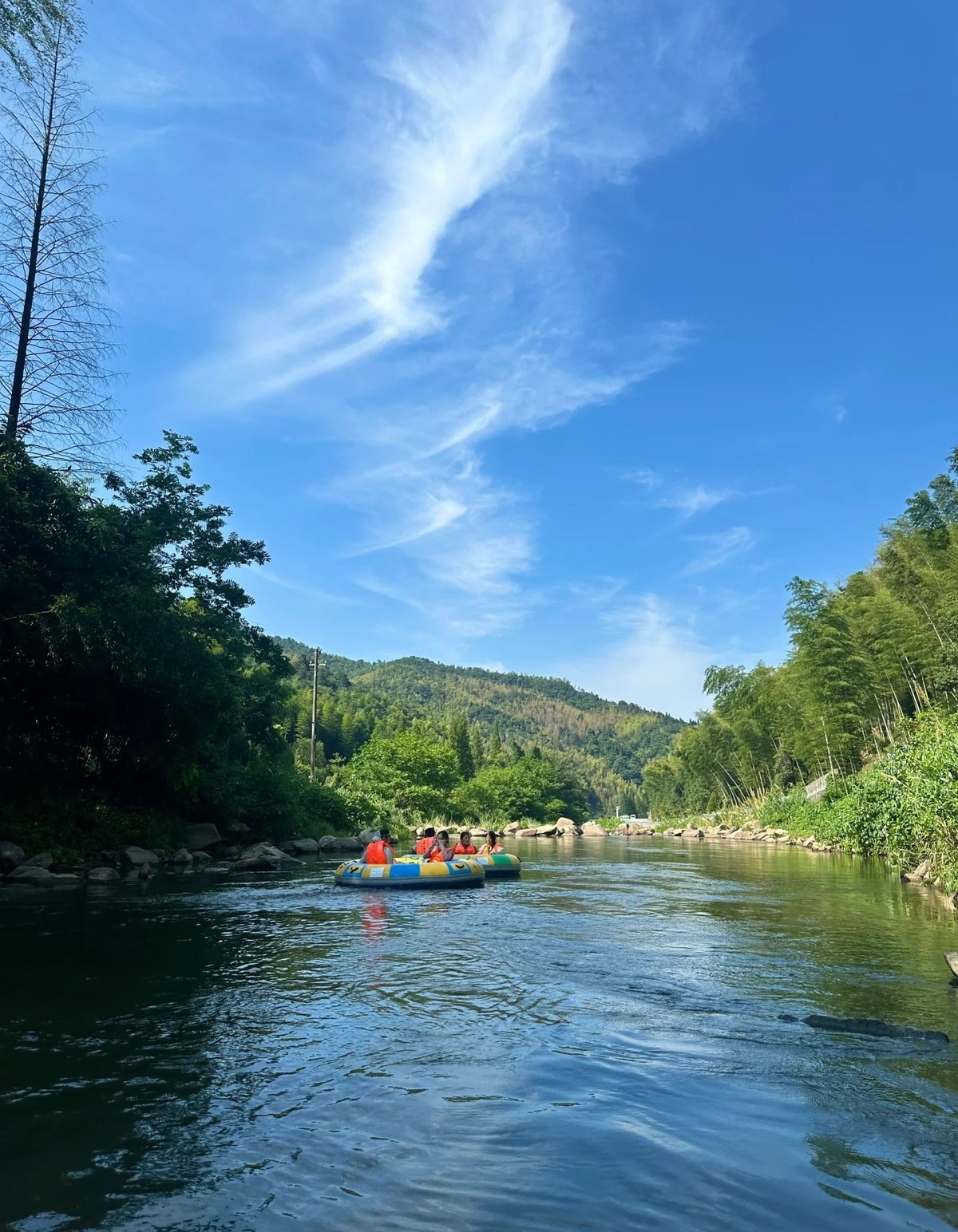
A raft-load in orange life jackets on one of the long flat stretches that make up most of the run — bamboo on the right bank, hill forest behind. The drops are short and come in bursts; this is the bit in between, and there's a lot of it.
But drive up the valley on a hot Saturday and rafting is not what most of the cars are here for. They have come to sit in the river.
Along the streams that drain the range, farmhouse restaurants and campsites rig canopies straight over the shallows on guy ropes, then put the tables and chairs in the water. You eat lunch and drink tea with your feet in a current running over pebbles. Timber cabins and decks line the bank behind, and there's usually a strip of tent pitches and pop-up gazebos where the water runs shallowest. Children work the edges with nets. In the settled stretches the water is ankle- to knee-deep and the bed is stones rather than mud, which is why this works so well with small children — and why nobody bothers with a swimming costume.
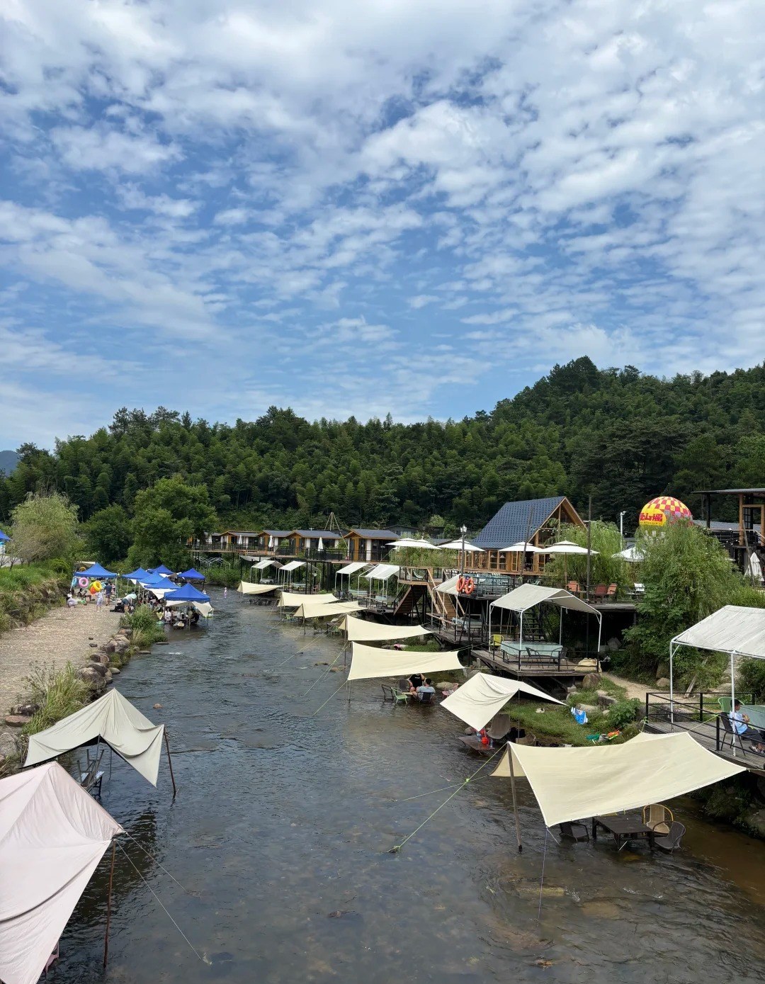
The Meiling summer, in one frame: canopies guyed out over the shallows, tables and chairs standing in the stream, timber cabins and decks along one bank and blue pop-up tents on the other. The water here is barely over the ankles, and the bed is pebbles all the way across.
The honest planning note: several of these are strung along the valley, and we could not verify names, prices or opening times for the individual ones. They vary, they change hands, and what's open depends on the water — a dry August or a big storm reshuffles the whole strip. Have your guesthouse or hotel ring round on the morning; that is exactly what locals do. The one place here with a proper public footprint is Nanping ancient village (楠坪古村), deep in the range: an emptied-out old village turned guesthouse cluster, something like 38 rooms spread across restored houses and woodland, a café, a marked tent-and-picnic area on the bank, and gentle knee-deep shallows clear enough to watch small fish over the pebbles. Local write-ups put the village's summer average around 25°C.
Now the part nobody puts on the poster. Mountain streams rise fast, and they rise because of rain you cannot see or hear falling a few kilometres upstream. If the water starts to cloud, if the level lifts, if you hear thunder up the valley — get out and get up the bank straight away, and don't stop to gather the picnic. Chinese safety advice after heavy rain is blunt and worth taking literally: stay off the streams for a day or two. Wet stream rock is slick enough to break a wrist on, so wear sandals or shoes with grip rather than flip-flops, and keep small children within arm's reach the whole time, however harmless the depth looks.
Otherwise, pack for it: a change of clothes, a towel, cash for a kitchen that may take nothing else, and sun cover — the canopies are shade, but water throws light back at you all afternoon.
Eating up here
Wanli's kitchens cook a distinct, hillier version of Jiangxi food, and it's a reason to come rather than a consolation.
One thing to sort out before you order: we could not find published prices for any of this, and farmhouse kitchens up here mostly don't display them. The hill chicken is sold by the bird rather than the bowl, and the bamboo banquet is priced as a set for the table — both can land well above what the same dish costs in the city. Ask what it comes to before it goes in the wok (duōshao qián, 多少钱), and agree the total for the table rather than dish by dish. Everyone local does exactly that; nobody will think you rude.
- The all-bamboo banquet (全竹宴) — the local set piece, built entirely from what the bamboo forest gives up: bamboo-fungus "eggs" done sweet-and-sour, young shoots with pickled greens, shredded rhizome flashed in a hot wok, bamboo-nest fungus through scrambled egg, oil-braised spring shoots. Best in spring when the shoots are new. Not fiery by default; say 少辣 (shǎo là) anyway if you want the Jiangxi heat down.
- Free-range chicken soup (土鸡汤) — the mountain's signature: a three-year-old hill bird simmered three hours to a deep gold. Order it before anything else.
- Clay-pot "immortal chicken" (砂钵神仙鸡) — the dish to look for around Taiping Xinjie, where one much-recommended kitchen trades as Shanquan Ziwei (山泉滋味). Village restaurants turn over; have your guesthouse confirm it's still open before you plan around it.
- Stream fish, dried-bamboo-shoot duck pot, red-braised pork (小溪鱼 / 笋干老鸭煲 / 红烧肉) — the standard farmhouse order for two or three, usually with a mountain vegetable thrown in.
Tea, up high
The altitude and the damp, cool air make genuinely good high-mountain tea, and the terraced gardens on the slopes below Lion Peak are picked in spring. A handful of small mountain tea studios will let you pick, watch the leaf being processed and sit down to a tasting, and one ridge garden is known for a full-tea banquet (全茶宴), where the leaf works its way into the dishes as well as the cup. These are one- and two-person operations rather than ticketed attractions, with no counter to walk up to and no English — so the move is to have your guesthouse ring ahead rather than turning up cold.
The morning-liquor market, which you should genuinely go to
Nanchang's most peculiar surviving ritual is zaojiu (早酒) — drinking, properly, at breakfast — and Wanli has organised it into a market. On market mornings the stalls on Tianning West Road at the Chenjia junction are going by about 6:30am: you buy raw ingredients — meat, river fish, greens, offal — carry them to one of the shopfronts around the market, and they cook them on the spot for a flat processing fee, published at roughly ¥5–15 a dish. Then you sit on a plastic stool at seven in the morning with a plate of Nanchang xiao chao (南昌小炒), a bowl of beef rice noodles and a glass of rice wine, among several thousand people doing the same. Two caveats: it runs on fixed market days, not daily — Mondays, Thursdays and Saturdays in the local government's own write-ups, though it's worth a check the night before — and it is loud, wet underfoot and entirely unbothered about you. That's the point of it.
Sleeping on the mountain
Staying up changes the trip, because of what the temperature does after dark. The summit guesthouses around Xiyao Lake are the original 1980s resort cluster — plain rooms, cold air, a thousand-plus beds between them, packed solid in July and August, so book well ahead for summer weekends. The courtyard inns around Taiping and Taiping Xinjie are converted family houses, often with dinner and breakfast included, which is how you end up eating hill chicken and home-grown vegetables at the owner's table: best value, most human contact. Newer guesthouse villages in the valley are tidier and blander. Booking any of them from abroad is the fiddly part — most list only on Chinese platforms and take phone reservations. If you'd rather not fight it, we can arrange the ridge night, the driver and the timing; that's what our plan-with-us trip service is for.
When to go
- Summer (June–August) — the whole reason the place exists. Cooler by 8–10°C on the ridge, waterfalls full, rafting running and the canopies up over the streams. Also the busiest: at weekends Nanchang decants onto the ridge, so go midweek and book any summit bed early.
- Autumn (October–November) — the prettiest. The maples in Sun Valley (太阳谷) start turning around late October and are usually best in mid-November; the thousand-year ginkgo at Taiping village is an October–November affair. The exact week moves with the first cold snap — check current reports rather than booking blind.
- Spring (March–April) — the greenest, and tea season. New shoots on every menu, picking on the high tea gardens, water in every gully. Also the mistiest: budget for a day when the summit is inside a cloud and you can see fifty metres.
- Winter (December–February) — quiet, occasionally white. The ridge sometimes gets snow and frost when the city gets only rain, which is why half of Nanchang drives up the moment it's forecast. Bare, cold, atmospheric; some seasonal operations shut.
Honest notes, and what to skip
- Don't try to "do Meiling" in one hit. It's a mountain range with a dozen separate entrances, not a park with a loop. Two pockets, three at most.
- The summit view is weather roulette. On a clear day you see the city and, at best, a long way over the Poyang plain; on a grey spring day you've paid for a ride into fog. The cableway is still fun in fog. The viewpoints are not.
- Lion Peak is harder than its modest height suggests. The stepped bamboo section is pleasant; the upper scramble isn't, and it's slick after rain. Proper shoes, not sandals.
- Skip the adventure add-ons if you came for the mountain. The glass slide and cliff swing are fine fun and interchangeable with a hundred other Chinese scenic areas. The 1185 inscription is not.
- Weekends and holidays are a different mountain — parking at the popular pockets fills by mid-morning and the ridge road backs up. Midweek is transformative.
- Bring more layers than the forecast suggests, plus bug spray from May to September and cash for village kitchens. English signage is minimal.
- If you only have half a day, do the cableway and the summit belt — unless you love history more than views, in which case do Hongya Danjing and pair it with Tengwang Pavilion in the evening, which closes the loop on the name Hongdu rather satisfyingly.
Practical info
- Getting there: Metro Line 1/2 to Ditie Dasha (地铁大厦), then bus 712 or 699 to Wanli Cableway Station (湾里索道站), 66 Shangren Street; or 30–40 min by Didi/taxi; or a hired car with driver (a foreign licence + IDP does not permit self-driving in mainland China).
- How long: half a day for the cableway and summit belt; a full day to combine two pockets; two days with a night on the ridge for the trails and the early-morning market.
- Tickets: the range itself is largely free. Lion Peak ~¥25, Shenlong Pool ~¥15, rafting ~¥88 in season (2.5–3 hours on the water), Ming–Qing dwellings park listed ~¥79, Hongya Danjing listed ~¥30, cableway ¥130 return standard. Farmhouse meals are unpriced — ask before ordering. Gates roughly 8–9am to 5pm. All variable — confirm on the day.
- Pay & language: Alipay and WeChat Pay nearly everywhere; carry cash for village kitchens and market stalls. Very little English — use Amap and a translation app.
- Good for: escaping summer heat, easy-to-hard day hikes, families (the streamside canopies more than the raft, if the children are small), photographers — Panlong Peak at dawn or after dark — and anyone who likes their scenery with two thousand years of footnotes.
- Less good for: tight one-day stopovers; wheelchair users beyond the cableway and Mopanshan's boardwalk; anyone who needs English signage and fixed timetables. Views are weather-dependent.
For where Meiling fits in a longer trip, see our Nanchang city guide and the Jiangxi summer escape itinerary, which strings the province's cool-air destinations together; the Nanchang photo spots guide covers the riverfront and skyline angles the ridge can't give you.
FAQ
Is Meiling worth visiting if I only have two days in Nanchang? Only if heat or hiking is your priority — with two days the riverfront, Tengwang Pavilion, the museums and the food are a fuller use of your time. With three days, or in July and August, half a day on the ridge is one of the best things you can do here.
How do I get to Meiling without a car? Metro Line 1 or 2 to Ditie Dasha, bus 712 or 699 to Wanli Cableway Station, then the cableway to the top in about sixteen to seventeen minutes. Didi runs door to door in roughly 30–40 minutes, but arrange the return ride in advance — coverage from deep in the range is thin.
How much does a day at Meiling cost? Most of it is free, including the ridge road, the trails and Mopanshan Forest Park. Lion Peak is around ¥25, Shenlong Pool around ¥15, summer rafting around ¥88, the Ming–Qing dwellings park listed around ¥79, and Hongya Danjing listed around ¥30. The cableway is the big item at ¥130 return standard. Confirm before you go — they change.
Is Meiling really cooler than Nanchang? Yes, noticeably. The summit area averages around 22.6°C in summer, commonly 8–10°C below the city — after a 38°C afternoon downtown you can be genuinely chilly at Xiyao Lake once the sun drops. Bring a layer even in midsummer. Note that the valley floors are milder than the ridge — the rafting valley is quoted at 4–5°C below the city, not 8–10°C.
Can you play in the streams at Meiling? Yes, and in July and August it's what most Nanchang families actually come up for. Farmhouse restaurants and campsites along the valley streams rig canopies over the shallows and stand the tables and chairs in the water, so you eat with your feet in the current; the settled stretches are ankle- to knee-deep over pebbles. Individual places don't publish prices or hours and change with the water, so have your guesthouse ring round on the morning. Mountain streams rise fast: stay off them for a day or two after heavy rain, get out immediately if the water clouds or the level lifts, and keep small children within arm's reach.
Can I hike Meiling without a guide? Yes — Wanli has published a signed trail network with distances and grades, from a 2 km valley stroll to a 22 km ridge day. Download offline maps, start early, and don't begin a long route after mid-afternoon; gates on the ticketed sections close around 5pm.
What should I eat at Meiling? Free-range hill chicken soup, the all-bamboo banquet in spring, dried-bamboo-shoot duck pot and stream fish at a farmhouse kitchen around Taiping. And if your visit lands on a Monday, Thursday or Saturday, go to the Wanli morning-liquor market on Tianning West Road at 6:30am for stir-fried breakfast with a glass of rice wine. Prices aren't posted at farmhouse kitchens up here — ask before you order.
Before you go
Prices, cableway timings, bus routes and rafting seasons here all change at short notice, and the cableway in particular pauses for weather. Check current fares and hours with the operator or a live listing before you set out, and let your guesthouse call ahead for anything you're relying on.
Last verified: 2026-08 — transit times, prices and hours change; please double-check official sources before you travel.